John: The Worst Ever King of England?

John_of_England_(John_Lackland)

This is my third post about King John, and I just thought that, having written about the 800th anniversary of his signing of the Magna Carta, it could be useful to have a look at the reasons why the barons decided that such a charter was necessary. Was John really that bad…?

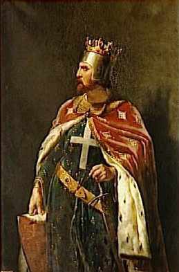
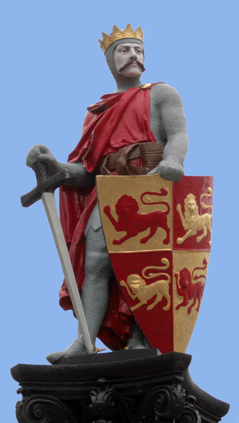
King John has the worst reputation of any English king. Other kings were seen as incompetent (Henry II) some as cruel (Richard III) but to his contemporaries, John was seen as both. It is true that most of the sources that condemn his actions were written by monks -and John was no friend of the Church – but his reign was obviously bad enough to lead to one of the most famous documents in history: the Magna Carta.

‘He feared not God, nor respected men.’ (Gerald of Wales)

‘A pillager of his own people.’ (the Barnwell annalist)

Just how true are these quotes?

John’s problems seem to have started on the day he was born…

John was born in Oxford on Christmas Eve, 1167, the last of the four children of King Henry II and the formidable Eleanor of Aquitaine.

John's parents: Henry II and Eleanor of Aquitaine, holding court. Anonymous. Public Domain
John’s parents: Henry II and Eleanor of Aquitaine, holding court. Anonymous. Public Domain

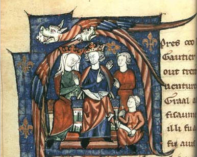
As such, he lived in the shadow of his older brothers: Henry, Geoffrey and Richard. At an early age he was given the nickname of ‘John Lackland’ because, unlike his elder brothers, he received no land rights in the continental provinces and was never expected to become king.

As a young man, Prince John was notorious for events during his role of Lord of Ireland. He squandered his money and offended Irish lords by mocking their unfashionably long beards. Then, in 1189, he broke his father’s heart by siding in a rebellion against him. On Henry’s death, since his two eldest sons had died by this time, Richard became the next king. All of Henry’s lands went to Richard, thus continuing his nickname of ‘Lackland’.

John was forever in Richard’s shadow. Richard was loved and respected by his subjects and his men, and famous for glorious deeds across the known world.

19th century portrait of Richard the Lionheart by Merry-Joseph Blondel (oil on canvas). Nor in the Palace of Versalles. Public Domain.

John could never compete. Richard even forgave John for rebelling against him and gave him To assure Richard of his newfound loyalty, John went to Évreux in Normandy and took a castle. Unaware of John’s reconciliation with Richard, the garrison thought he was still allied to King Philip of France and accepted him. John massacred them all.

So John already had a reputation for treachery before he became king – a reputation that worsened after Richard I was killed by a crossbow wound in 1199 and John took the throne.

19th century drawing of a scene from 'King John' by Thomas Nast. Folger Shakespearean Library. Commons.
19th century drawing of a scene from ‘King John’ by Thomas Nast. Folger Shakespearean Library. Commons.

His reign started reasonably well, although many incidents soon occurred. War broke out with France again and King Philip supported 16-year-old Arthur of Brittany against John.  As the son of John’s elder brother, Geoffrey, many believed Arthur was the rightful heir.

Chateau de Falaise, where Arthur was imprisoned by John. Uploaded by Ollamh. Commons

There are sources that suggest that John was responsible for Arthur’s death. Some maintain that John killed him in a drunken rage and dumped his body in the River Seine; others say that Arthur died after being castrated. However the boy died, it is believed to have been at John’s hands.

The Murder of Pronce Arthur by Thomas Welly, 1754. Source: Hulton Archive. Public domain.
The Murder of Prince Arthur by Thomas Welly, 1754. Source: Hulton Archive. Public domain.

John was always at loggerheads with the Church, one incident being particularly noteworthy. This was over John’s protest at Pope Innocent III’s choice of Cardinal Stephen Langton as Archbishop of Canterbury. In 1208, the pope placed the whole of England under papal interdict. Church services and sacraments were suspended across England (except for baptism and extreme unction). Bodies were buried in woods, ditches, and by the side of the road. Only two bishops remained in England. The following year, the pope excommunicated John from the church.

John raked in money during the interdict, exploiting the weakened Church and amassing the huge sum of over £65,000 (£30 million in modern money). But the interdict also encouraged John’s enemies. King Philip of France planned an invasion in 1213 with papal blessing. As John wanted Rome on his side, he dramatically submitted to Rome and accepted Langton as Archbishop of Canterbury. And a surprise attack by English naval forces in May, 1213, ended Philip’s threat.

Coronation of Philip Auguste in the presence of Henry II of England. Uploaded by Jan Arkensteijn. Public Domain
Coronation of Philippe Auguste in the presence of Henry II of England. Uploaded by Jan Arkensteijn. Public Domain

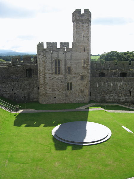
During the interdict, John had been free to impose his dominance over the British Isles. He made the old Scottish king accept costly and humiliating terms. In 1210, he led a force of 800 men to Ireland to quell an open rebellion against him led by powerful lords such as William Marshal, William de Braose and the de Lacy Brothers – who were protesting at John’s financial and political demands for funds in his campaigning in France. The barons submitted or fled. In Wales, Llywellyn the Great also rebelled, but faced with John, he retreated into the hills of Snowdonia and agreed to harsh terms.

Statue of Llywellyn the Great in Conwy. Uploaded by Rhion. Public Domain

The act that one historian described as ‘the greatest mistake John made during his reign’ involved John’s heinous treatment of the family of William de Braose.

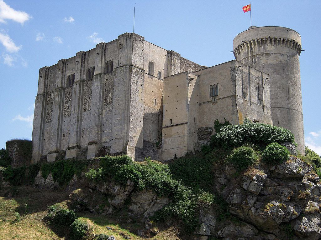
The rebellion in Ireland gave John the excuse he needed to go after a personal enemy. De Braose had been John’s right hand man for years. In 1201, John offered him the honour of Limerick in Ireland for 5,000 marks. Six years later, de Braose still owed most of the money.  After the rebellion in 1210, de Braose fled to France, but his lands and his wife, Matilda, and his son were still in Windsor Castle. John moved them to Corfe Castle in Dorset and threw them in the dungeon, where he let them starve to death … perhaps his most notorious and malicious act. One chronicler reports that the bodies were found with the mother slumped across her son, with her head lying on his chest. She had been gnawing at his cheeks for food. Rumours circulated that John had killed them because they knew the truth about Arthur of Brittany’s death. William de Braose had been with John at the time of the boy’s disappearance.

Many of the barons did not feel safe after the de Braose affair. They also had many, accumulated grievances regarding financial burdens, the nature of John’s rule and penalty system and personal grievances about his notorious womanising and taking mistresses – even the wives and daughters of powerful men. The final straw came after John’s long-awaited attack on France ended in defeat and John returned, demanding even more scutage from them…

In 1215 the barons broke homage to John and formed the Army of God and the Holy Church – a declaration of war on the king. They offered the crown of England to Prince Louis of France, King Philip’s son and heir, if they would cross the Channel with an army to help them. On the 17th May, the barons seized the capital of London and drew up their demands in a document originally called the Articles of the Barons.  It was the first draft of what later became known as the Great Charter – the Magna Carta.

John,_Magna_Carta
19th century wood engraving of King John signing the Magna Carta. Public Domain.

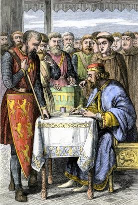
By October 1215, after the signing/sealing of the Magna Carta at Runneymede in June – a treaty that John had no intention of keeping – war with the barons resumed. In May 1216, Prince Louis of France invaded with a powerful force in support of the English barons who had wanted him crowned king in place of John. John spent the rest of his reign trying to regain control of his kingdom. At Lynn (now King’s Lynn) in October he fell ill, possibly of dysentery. On October 11th he led his army on a short cut across The Wash at low tide – a disastrous move. Whether due to the returning tide or the quicksand there, his baggage train and treasure were lost beneath the waves. This was the last disaster of a disastrous reign.

John’s health rapidly deteriorated and he headed for Newark Castle on a litter, reportedly ‘moaning and groaning’ that the journey was killing him.


On arrival he confessed his sins and received Communion for the last time. He died on the night of 18/19 October in the middle of a great storm.

Drawing of the effigy of King John in Worcester athedral from 'History of England'Gy Samuel R. Gardiner. Public Domain
Drawing of the effigy of King John in Worcester Cathedral from ‘History of England’ by Samuel R. Gardiner. Public Domain

*Note: The header image shows John of England (John Lackland) by Matthew Paris from his Historia Anglorum, 1250-59. British Library royals MS. Public Domain.

King John is at Newark!


008 Newark Castle (Header)

I intended to write this post before I headed off to Hadrian’s Wall a couple of weeks ago but, as usual, I didn’t manage to fit it in. I particularly wanted the post at that time, as it was to be a ‘follow up’ to the one on the Magna Carta I’d done the week before (here). Still, the Magna Carta celebrations in Lincoln will continue into October, and I suppose any information about King John could be shared at any time. So here it is now…

Over the weekend of July 22, about forty members of the re-enactment society, Regia Anglorum, presented a living history ‘encampment’ in the grounds of Newark Castle to demonstrate  to visitors how people would have fed and clothed themselves at the time of King John and demonstrate use of their weaponry skills. The society was invited to Newark by the castle warden as part of the region’s celebrations to mark the 800th anniversary of the Magna Carta.

Newark is about 18 miles away from Lincoln, and the castle at that time belonged to the Bishop of  Lincoln, who was also present. Here are a few photos of what is left of the castle today. Some are of the outside from across the River Trent and others are views of the inside of the curtain walls and gates:

And here are is a photo of King John as he looked on this occasion. John is the one in the decorative blue tunic, enjoying a snack:

015 King John (2)

And this is the Bishop of Loncoln, inside his tent:

044 Bishop of Lincoln (2)

Medieval characters were milling about enjoying the day or gossiping around the camp:

Throughout the day, display tents were set up to demonstrate the different roles in 13th century society – from shoemakers, leatherworkers, metalworkers, chainmail and jewellery makers to those carving a variety of everyday goods from deer antler, such as combs, needles and gaming dice. Other stalls displayed common foods eaten and demonstrated cooking methods:

The highlight of the day was a tournament put on by twenty members of Regia Anglorum. Warriors came from all ranks of society – peasants, sergeants and knights – to entertain King John and the Bishop of Lincoln, the Right Rev Hugh de Wells, with their skills – some of them hopeful of being selected as future knights. The king and bishop put on jovial faces for the tournament, when in reality (according to the actor who played the bishop) relations between the two were never easy. At one time he had been banished by John.

Here are some pictures of the tourney and preparations made by the combatants beforehand. Squires were on hand to assist the knights into their gambesons (padded jerkins) and heavy chain mail. King John certainly seemed to be enjoying himself:

King John has often been linked with the Nottingham-Newark-Lincoln area through the many legendary tales about Robin Hood and Sherwood Forest, which once covered much of this area. But perhaps an even greater link with Newark is that he died inside its castle:

By October 1215, after the signing of the Magna Carta at Runneymede in June – a treaty that John had no intention of keeping – war with the barons resumed. In May 1216, Prince Louis of France invaded with a powerful force in support of the English barons who had wanted him crowned king in place of John. John spent the rest of his reign trying to regain control of his kingdom. At Lynn (now King’s Lynn) in October he fell ill, possibly of dysentery. On October 11th he led his army on a short cut across The Wash at low tide – a disastrous move. Whether due to the returning tide or the quicksand there, his baggage train and treasure were lost beneath the waves. This was the last disaster of a disastrous reign.

John’s health rapidly deteriorated and he headed for Newark Castle on a litter, reportedly ‘moaning and groaning’ that the journey was killing him. On arrival he confessed his sins and received Communion for the last time. He died on the night of 18/19 October in the middle of a great storm.

*

Lincoln and the Magna Carta

023 Barons' ShieldsOn June 15, 1215 – or 19th according to some sources – at a place called Runneymede (near Windsor) on the River Thames, King John of England reluctantly signed a treaty with the powerful barons of the realm. The document was a series of written promises that John would govern the country and deal with its people according to the customs of feudal law. In other words, the charter was an attempt by the barons to stop John from abusing his power and the people of England suffering as a consequence. The charter became known as the Magna Carta: Latin for the Great Charter. Here are a couple of artistic interpretations of the signing:

John,_Magna_Carta
19th century coloured wood engraving of king John signing the Magna Carta. Public Domain
800px-Link_John_Magna_Charta_by_Ernest_Normand
Link John Magna Charta by Ernest Normand, 1900. Uploaded by william Avery. Public domain

By 1215, John had been king for 16 years, and had a series of mistakes, misdemeanours, and cruel or treacherous acts behind him and at last the barons had snapped. I intend to look at some of these in another post, but today, I want to think about the Magna Carta.

2015 marks the 800th anniversary of the signing of the Magna Carta. Several copies were originally made and delivered to religious establishments all over the country. Only four of these copies are still in existence today: two in the British Library, one in Salisbury Cathedral and one belongs to Lincoln Cathedral but is on display in Lincoln Castle. Lincoln’s copy has been in the city since it was sealed by King John – it even has instructions to deliver to ‘Lincolnia’ written on the back.

Lincoln is also the only place in the world where you can find an original copy of Magna Carta together with the Charter of the Forest, issued in 1217 to amplify the document, and is one of only two surviving copies.

Throughout the summer, Lincoln has been celebrating this momentous signing, along with several other places around the country. And since Lincoln is only 7 miles away from where we live, Husband and I decided to pop along and have a look.

Lincoln Castle is worth a post on its own – another one I have planned for later on. It’s a fine old Norman structure, unusual in having two keeps. The County Law Courts are still located inside the castle, as is the old prison – well worth a visit in itself. It is in the subterranean vault inside the prison building that the Magna Carta is on display. It’s the red brick building in the photo (bottom left) below.

Unfortunately, the controlled lighting in the vaults makes taking photographs impossible. Flash photography is a no-no. So I have no photos of the documents to show. But there are some online that can be seen.

As part of the anniversary celebrations in Lincoln, the organisers have created the Barons’ Charter Trail for children to follow. Twenty five fun ‘barons’ have been created, all painted in bright colours and given amusing names like ‘Truck Driver Baron’, ‘Wild Flower Baron’ and ‘Lincolnshire Waterways Baron’. They are spread out across the cultural and commercial areas of Central Lincoln. On finding all 25, and copied down the code for each, children collect a bag of King John’s gold – in other words, chocolate money.

We found all of these ‘barons’ and here is a selection of them:

The barons’ shields, used as the header image above, are on display on the wall outside the vault where the documents are housed.

A week after this visit to Lincoln Castle, we had a visit to nearby Newark Castle, where a  re-enactment group were putting on a display about John and medieval life in general. We have some good photos of that event, too. Needless to say, John is featured a lot this summer. He was an interesting character, and one of the most memorable kings in English history.

WW1 Day at Crich Tramway Museum

082

Last Sunday, July 19, we headed off to Derbyshire with our 16-year-old grandson to visit the Crich Tramway Museum (the letter i in Crich is pronounced like the word ‘eye’). The museum is situated in the Crich Tramway Village, close to the town of Matlock and is an hour-and-a-half drive from where we live:

Map of Derbyshire civil parishes, highlighting Matlock Town. Author: Rcsprinter. Commons

We specifically picked this weekend because it was a World War One weekend, and the event was attended by a number of people in period costume or WW1 army uniform. A re-enactment group were also in uniform or other Edwardian dress. Shop windows displayed WW1 foods and there were various recruitment posters about:

It’s thirteen years since we last visited Crich, when Kieran was only three. On that occasion, it was a Thomas the Tank Engine weekend, and Kieran was mad about all the different, colourful engines. His love of Thomas and friends dwindled very soon afterwards, when real steam engines took over. His passion for those has never waned. In fact, trams fall a long way short for him, but he enjoyed the day well enough.

The heart of the village is Tramway Street, a cobbled street with a shiny ‘lacework’of metal running along it, flanked by period buildings. Above, the overhead wire has been described as ‘a mad woman’s knitting’. Both the tracks and wires have been retrieved from towns and cities all over the country…

… as have the buildings and street furniture, some of which were moved stone by stone from their original destinations. There is a pub – the Red Lion Pub, a cafe (Rita’s Tearooms) an old-style sweetshop, the Yorkshire Penny Bank and the impressive Derby Assembly Rooms with its grand Georgian frontage (originally built between 1765 and 1774). It now houses the video theatre and other displays about Britain’s tramways. There is a bandstand in a little park area, and a number of old gas lamps and a couple of telephone boxes. The village is also home to the Eagle Press, a small museum dedicated to letterpress printing, including an 1859 Columbian printing press:

The Bowes-Lyon Bridge (seen above) crosses the road. From up there we could watch the trams going underneath us. These pictures give a good view of the ‘mad woman’s knitting’ design of the wires, with the tracks beneath:

There are fifty trams on display at Crich, both single and double-deckers, some from places abroad, including France, Germany, Belgium, Portugal, South Africa and the U.S. The idea is to portray each of the significant stages in the evolution of the British tramcar. The gaps have been filled in with tramcars from outside the U.K.

Several trams run through the village and visitors can ride up and down the one-mile track along the edge of the beautiful Derwent Valley.

019 (2)

018 (2)

Visitors can get on and off a variety of trams at different spots to view the sites. These include a lead mine, with the rails for the trolleys, a woodland walk with some unusual wooden sculptures (several of the Green Man) and views of the quarry:

The Derwent Valley was named a World Heritage Site by UNESCO due to its historical importance. The valley can rightly be described as the birthplace of the Industrial Revolution. The village of Cromford, only a mile away, was where Richard Arkwright built his new mill in 1771. George Stevenson, the great railway pioneer, had a close connection with Crich and the present tramway follows part of the mineral railway he built to link the quarry with the village of  Ambergate.

On their arrival in Britain in 1860 from the US (where they were developed) trams were welcomed as a means of transport that gave a far smoother ride than previous horse drawn buses. They also provided a far cheaper form of urban transport for the masses. When the electric tram arrived in 1900, it was a wonder of the age. By the 1920s there were 14,000 electric trams in Britain. The trams at Crich mostly ran along the streets of cities in United Kingdom before the 1960s, with some trams rescued and restored (even from other countries) as the systems closed.

Besides the trams constantly rumbling along the streets, there are many inside the exhibition halls to be brought out on different days, and some in the workshop undergoing restoration:

Decline of the trams came after WW1, notably when the internal combustion engine was developed. Vehicles powered that way offered reliability and perceived low cost, and were not restricted to rails. However, it took many years before buses became swifter and carried more passengers than trams. Even when the motor car was developed, public transport still thrived. But few towns invested in new trams and the cheaper buses eventually took over. By the 1950s only a handful of tramway systems were left. Blackpool closed before the 60s and Glasgow Corporation Tramways in 1962.

There has been a recent revival with new networks such as the Croydon Tramlink, Sheffield Supertram, Midland Metro, Edinburgh Trams, Manchester Metrolink, and Nottingham Express Transit being built and extended. Whether or not other cities will follow remains to be seen.

Here’s a smile inducing piece of information to end with, complete with illustration, from inside the Discovery Centre:

The Holy Island of Lindisfarne

1024px-Lindisfarne_Lobster_Pots

This week’s prompt for Flash Fiction for Aspiring Writers reminded me of one of my favourite spots to visit in the UK: Lindisfarne (or Holy Island). So I have TJ Paris to thank for bringing it to my mind.  This is his photo . . .

wpid-photo-20150720132321474

. . . and my story can be read here.

I would normally add a little bit of ‘extra’ information at the end of my story each week, but I thought this was a little too long for that today. So here it is, as a separate post:

I’ve always been fascinated by offshore islands, whether inhabited by humans or simply by colonies of seabirds. It has been suggested that there as many as 5000 islands in total around the coast of the UK – a number difficult to verify as it depends on a person’s definition of an island. Some ‘islands’ may be just small lumps of rock. But there are certainly more than 1000.

As for Lindisfarne, it is well worth a visit. We usually head up there when we’ve been staying around Hadrian’s Wall, just for a change for a day out. It has a lot to offer for tourists, including the requisite souvenir shops, hotels, restaurants and cafes etc. Of course, most people go there to see the historical sites.

Lindisfarne lies just off the coast of NE England, in the county of Northumberland. It is connected to the mainland by a tidal causeway, and there is a castle and priory on the island.

(Note.  A causeway is a raised road or track across low or wet ground. e.g. “an island reached at low tide by a causeway”)

Map of Northumberland showing offshore islands. Author: Nilfanion. Commons
Map of Northumberland showing offshore islands. Lindisfarne is the larger, more northerly isle. Author: Nilfanion. Commons
Simplistic map of Holy Island. Author: Fhah 4. Commons

Lindisfarne has recorded history from the 6th century, although we know the Romans were in the area much earlier, and there could have been a village of Britons on the isle. In the 6th century, Lindisfarne was an important centre for Celtic Christianity under Saint Aiden, who came from Ireland and established an Irish-type wooden monastery with a small church and various huts and workshops. He eventually became Bishop of Lindisfarne and was buried there in 651. But at the end of the 9th century, when the priory was abandoned, his remains were taken to Durham Cathedral, where they still remain today. Ther is a statue of St. Aidan by the Priort ruins, which are on the site of the monastery built by him:

Lindisfarne Priory ruins and statue of St. Aidan. Author: Kim Traynor. Commons

Much is written about the history of Lindisfarne and the ‘saints’ who came after St. Aidan. But the event that captures most people’s interest – most certainly mine – is that of the Viking raid on the island in 793. This event is now taken to be the beginning of the Viking Age.

Here’s the modern English version (as opposed to the Anglo Saxon one) of the raid, from the Anglo Saxon Chronicle:

“In this year fierce, foreboding omens came over the land of the Northumbrians, and the wretched people shook; there were excessive whirlwinds, lightning, and fiery dragons were seen flying in the sky. These signs were followed by great famine, and a little after those, that same year on 6th ides of January,* the ravaging of wretched heathen people destroyed God’s church at Lindisfarne.”

 (*The generally accepted date for the Viking raid on Lindisfarne is 8th June, when sailing across the North Sea would have been more likely for the Vikings. The’ 6th ides of January’ is now considered to be a translation error.)

Alcuin, a Northumbrian scholar at Charlemagne’s court at the time, wrote:

“Never before has such terror appeared in Britain as we have now suffered from a pagan race. . . The heathens poured out the blood of saints around the altar, and trampled on the bodies of saints in the temple of God, like dung in the streets.

These raids by Norwegian Vikings were not followed up. Most of the later raiders sailed north around Scotland. The 9th century invasions came from the Danes … which, of course is the topic of my books.

The Priory on Lindisfarne was built in the 11th century on the site of the Irish-styled monastery founded by St. Aidan in 636. Here are some pictures of the ruins today.

Remains of Lindisfarne Priory: 1798 by Thomas Girton. The priory's rainbow arch (which still survive) is shown truncated for artistic effect.
Remains of Lindisfarne Priory: 1798 by Thomas Girton. The priory’s rainbow arch (which still survives) is shown truncated for artistic effect.

The castle was built in 1550 by Henry VIII in defence of the realm against attack by Scotland and in pursuit of their Spanish allies.  It is said to have been constructed of stone taken from the priory.

Londisfarne Castle from the harbour on a rainy day. Author: Russ Hamer. Commons
Lindisfarne Castle. It is sited on top of a volcanic mound known as Beblowe Craig. Author: Matthew Hunt. Commons

The Lindisfarne Gospels are among the most celebrated illuminated books in the world. A 10th century inscription at the end of the text was made in honour of God and Saint Cuthbert by Eadfrith, Bishop of Lindisfarne, who died in 721. The Lindisfarne Gospels are part of a collection of Sir Robert Cotton (died 1631) in the British Library in London.

Folio 27r from the Lindisfarne Gospels contains the incipit from the Gospel of St. Matthew. Uploaded by Airump. Public Domain
Lindisfarne Gospelsshowing John the Evangelist. Permission PD-Art. Public Domain

Beaumaris Castle

Aerial view of Beaumaris Castle on Anglesey, Wales: By Cadw, Wales
Aerial view of Beaumaris Castle, on Anglesey, Wales: By Cadw, Wales

Beaumaris was the last of the three castles I visited on my trip to North Wales two weeks ago. It is situated on the Island of Anglesey across the Menai Strait and reached by the road bridge. There is also a rail bridge, and both bridges get a fair amount of traffic, especially in the summer months. Tourists come to visit Anglesey itself or to get to Holyhead for the ferry across to Ireland.

North Wales Castles

Begun in 1295, Beaumaris was the last of the royal strongholds to be built by Edward I in Wales, so completing the ring of fortresses he had begun in 1277. By 1295, King Edward had built or refurbished 16 castles, and it seems that the one at Beaumaris had been planned as early as 1283.

Yet it was not until twelve years later that work began on the ‘fair marsh’ – Beau Mareys in Norman-French. Initially, great progress was made with the building. In the first year, 450 masons, 400 quarrymen and 2,000 labourers worked to dig the moat and begin constructing the towering walls.

Like the castles at Rhuddlan, Aberystwyth and Harlech (and unlike those at Conwy and Caernarfon, where the shape was determined by the contours of the underlying rock) Beaumaris took advantage of the flat site and was designed in the concentric plan. The main courtyard /inner ward is surrounded by a narrow encircling ward and both are then protected by an outer moat with a controlled supply of tidal water.

beaumaris_plan_cadw (2)

Below are a few views of the outer walls, the moat (with resident swans and their cygnets) and the main entrance (called ‘The Gate Next the Sea’). Alongside this gateway is the castle dock, where boats would have moored while their cargoes were unloaded directly into the outer ward.

The gateway itself was defended in three ways. First was the drawbridge across the moat, which would be raised at the first sign of alarm. Then there was the portcullis, the grooves along which this would have operated can be seen on two of the photos above. Above the inner passageway were the ‘murder holes’, one of which can be seen in the middle photo on the last row, above. Through these, attackers who succeeded in getting through the two outer defences would have met with boiling oil, as well as a barrage of arrows through arrowloops along the passageway wall. Lastly was a heavy, two-leaved door.

Today, the castle is approached across a wooden bridge over the moat instead of a drawbridge, and through the main entrance into the outer ward. These are shown on the larger photo, top left, above.

There are several information posters around the site. This one below is about the outer ward. If you’re good at reading Welsh, try the information at the right hand side! Note the interesting snippet and ‘view through the wall’ diagram showing castle loos (bottom left illustration):

The inner gatehouse – through to the inner ward – was defended by three successive pairs of barrel gates and portcullises. It was sited deliberately off-line to force attackers into exposing their left flanks to archers waiting along the top of the inner gatehouse and wall.

The symmetry of the castle is impressive (as evident on the above plan) although the skyline has been described as visually disappointing. It lacks the turrets of Caernarfon. Conwy and Harlech and has a definite squatness that fails to dominate its surroundings. This is because, although the work went on for 35 years, when it finally ceased in the 1330s, the towers of the inner ward were still without their top storeys and the planned turrets were never even started. There were plans for 5 separate suites of lavish accommodation, 3 of which remained unfinished. Unfortunately, Edward simply ran out of money.

Here are a few photos of the inner ward and a couple looking out from the top of the inner wall over the Menai Strait toward mainland North Wales. The seagull was also nesting along the top of the inner wall.

Beaumaris Castle has relatively little recorded history. Any sieges it had to withstand were not the kind to add much to its story, as those at Harlech. Like all the North Wales castles, it was held for the king in the civil war (1642-49) and surrendered to Parliament in 1646. Some partial works of demolition were carried out after that war, but most of the original structure has remained standing until the present time.

Next time I go to North Wales, I’ll be aiming for the castles at Harlech, Rhuddlan (which is just a ruin) and Chirk. I camped in the grounds of Chirk Castle many years ago, when I was a robust Girl Guide at the age of thirteen. Happy memories!

***

A Visit to Caernarfon Castle

800px-Caernarfon_Castle_1994

This is the third of my posts about some of the places I visited in North Wales the week before last. The first was about the beautiful Bodnant Gardens and the second about Conwy Castle, one of the three different castles we went to see. Today’s post is about Caenarfon Castle along the coast to the south-west of Conwy.

North Wales Castles

Caernarfon was one of a series of castles built by King Edward I of England after the second Welsh war of independence in 1282. Building began in 1283 and the castle became his royal palace-fortress instead of the originally intended castle at Conwy.

For the Welsh, Caernarfon was already an important and mythical place. The Romans built a fortress here (Segontium)  in AD 77 and legend holds that a Roman emperor called Macsen Wledig (Magnus Maximus) married a local princess. It is thought that this link with the powerful Romans was the reason why Edward I chose Caernarfon as his royal ‘capital’ and had it built with colour-banded walls, emulating the walls of Roman cities and perhaps even Constantinople itself.

Following the Norman Conquest of England in 1066, a motte and bailey castle was built close to the site where the Edwardian castle would one day stand. Many of these early castles were erected quickly, all over England, generally constructed of wood at first and replaced by stone some time later. Motte means ‘mound’, which could have been a natural one, or one raised specifically for the purpose of supporting the keep, or fortified tower. Below the motte would be the bailey (an enclosure or courtyard) in which the kitchens, stables and storehouses would be situated. Here is an examples of an English motte and bailey castle, just to show what they looked like. Note, this is not the one at Caernarfon. There is little evidence of that left.

Carisbrook motte and bailey castle. Auhor: Charles D.P. Killer. Commons

It is thought that the motte of the Norman castle at Caernarfon was incorporated into Edward I’s castle, although the location of the bailey is uncertain.

The design of Caernarfon Castle is rather like the number 8 – it’s been described as having and hour-glass shape (plan below). The coloured banding of the stone and the octagonal towers make it an impressive site from a distance, especially viewed from the Menai Strait. Unfortunately, it was a grey and miserable day when we went to Caernafon, so the castle has a particularly dark and menacing appearance. The main entrance shown in one of these photos is the King’s Gate.

This is a general plan of the  castle:

Caernarfon_Castle_plan_labelled

A. Site of the Watergate  B. Eagle Tower  C. Queen’s Tower  D. Well Tower E. Lower Ward F. Great Hall  G. Kitchens  H. Chamberlain Tower  I. King’s Gate  J. Upper Ward  KBlack Tower  L. Granary Tower  M. North- East Tower  N. Cistern Tower  O. Queen’s Gate

And here is a mix of photos from inside the castle, mostly from around the Upper and Lower Wards:

The Eagle Tower is one of the greatest of the castle’s towers and there are interesting displays in there. In the photos above it’s the one with the pennants flying. It was probably designed to provide accomodation for Sir Otto de Grandison, the king’s lieuteanant. Inside is a basement and three storeys and outside, a very weathered eagle sits on top of the west turret (left hand side turret on the photo). No? I could hardly see it, either…

According to tradition, Edward’s son, Prince Edward of Caernarfon (and future Edward II) was born in Caernarfon Castle on April 28 1284. In 1301 he was created Prince of Wales:

300px-Edward_I_&_II
Edward I creating his son, the later Edward II, Prince of Wales in 1301. Source: British Library (scanned). Author, User:Lampman. Public Domain

Since then, the title has been traditionally held by the eldest son of the monarch. On the 28 July 1958, the investiture of Prince Charles, eldest son of Queen Elizabeth II took place in Caernarfon Castle. The circular disc in the photos above marks the place.  This picure from Wikimedia Commons shows a wider view of the area:

450px-Caernafon_Black_Tower
Caernarfon Castle, site of the Investiture of Prince Charles in 1958 . The Black Tower is seen behind it. Author: Albertistvan. Commons

The Queen’s Tower (C on the plan) and two floor of the Chamberlain’s Tower (H) now house the regimental museum of the Royal Welsh Fusiliers. Through the walls from one tower to the other are lots of information panels. We didn’t go into this area on this occasion, but for anyone interested in mlitary history it’s worth a visit.

For two centiuries after Edward’s time, his arrangements for the governing of Wales still held. There were periodic revolts, as the one in 1400-15 when the castle was besieged by the Welsh supported by the French.

The ascension of the Tudors, who were Welsh, eased hostilities between England and Wales and castles became less important. The Tudors changed the way that Wales was governed and castles became neglected. Many fell into decay. Although Caernarfon’s walls remained in good condition, the roofs and much of the timber rotted. Domestic buildings were stripped of anything of value (e.g. glass and iron) but the castle was in good enough condition to be garrisoned by Royalists troops during the civil war of 1642-49.

As with Conwy, there is so much that could be said about this castle. But enough is enough for one post.

Castles of North Wales: Conwy

800px-Conwy_Castle_and_car_park_from_Town_Walls_-_geograph.org.uk_-_1723358
Conwy Castle and car park from the Town walls, viewed from the south west. Source: geograph.org.uk. Author: David Dixon. Creative Commons

The castles of King Edward I (1272-1307) in North Wales are amongst the finest medieval buildings in Britain. They were all built from scratch, often concurrently, in the unsettled aftermath of war. During my trip to Wales last week I’ve been to see just three of these castles. The simple map below shows their locations. Beaumaris is on the Island of Anglesey, across the Menai Straits:

North Wales Castles
Map showing three North Wales castles. Base map from Image:uk map,svg. Author: Paul at wts.wikivoyage. Wikimedia Commons.

Conwy Castle was built on a new site in the spring of 1283 as part of a ring of fortresses encircling the Welsh heartland of Snowdonia in Gwynedd. It followed Edward’s victory of his second campaign to subdue the Prince of Wales, Llwelyn ap Gruffudd. There had been conflicts in this region for many years between the Plantagenet kings of England (John 1199-1210 and Henry III 1216-72) and the princes of Gwynedd – notably Llwelyn ab Iorwerth, also known as Llwelyn the Great. (ab/ap are derived from the Welsh word mab, which means ‘son of”.)

Neither John nor Henry challenged the Prince of Gwynedd successfully, and on Edward’s succession in 1272 the prince’s refusal to do homage to the English king resulted in the war of 1276 -77. Edward’s victory was rapid – if, ultimately, inconclusive – but his second war (1282-3) proved more decisive.

The castle was built as part of a wider project to create the walled town of Conwy in order to control an important crossing point over the River Conwy. The whole project cost £15,000 – equivalent to £45 million today. The castle was intended as a centre for the administration for the area, but Caernarfon became the shire town and assumed that role. Edward only stayed at Conwy once.

Here are a couple of pictures of a model on display inside the castle. They show the castle and part of the walled town as they would have originally looked. Note the direct access to the River Conwy:140

144

The plan below shows the castle from the same (south) side as the last picture. The plan is roughly rectangular, with four towers spaced regularly along each side. The bulging outer (south) wall can be seen clearly on each, probably the result of the builders following the contours of the rocky outcrop. The great hall and chapel in the outer ward curves in line with this wall. The four towers closest to the river have small, round turrets overlooking the inner ward, where the royal apartments were located.

800px-Conwy_Castle_plan
Conwy Castle plan. Source: Cadw. Open Government Licence. Wikimedia Commons.

The castle is noted for its high towers and curtain walls, and its excellent state of preservation:

Inside the imposing outer shell the castle contains the most intact set of residential buildings left by medieval English monarchs in Wales or England. The outer ward – 2/3 of the main castle area – contains the great hall and chapel, as well as the chambers, stables and kitchen that served the garrison.

This is the outer ward. The two photos, bottom left are of the great hall and chapel. The chapel is at the far end, where the arched window can be seen.

The inner ward has the private chambers (top left photo below) and the royal chapel. A water gate, leading to the east barbican (gateway) provided private access for the king and queen. Here are some photos taken mostly from around the battlements, with an odd one or two inside the towers. Most look down into the inner and outer wards, or show views out across the River Conwy:

The suspension bridge ascross the R. Conwy (middle bottom) was designed by Thomas Telford and completed in 1826.

I’ve missed out so much detail about Conwy Castle, as well as many of the photos we took, otherwise this post would become a marathon.

Beautiful Bodnant

080This week, I am away from home (with Husband, of course) staying at a hotel in Chester, very close to the Welsh border. This is an ideal place from which I can visit my family in Lancashire and Wales as well as revisiting some of the wonderful castles along the North Wales coast and the Roman and medieval sites around the city of Chester itself.

Oddly enough, our first visit was to somewhere quite unplanned. Whilst visiting my aunt and uncle at Penrhyn (in the county of Conwy) along the coast of North Wales, we decided to take a trip to Bodnant Gardens, nestling in the foothills of Snowdonia, just five miles inland from their house.

Bodnant has been described as one of the world’s most “magical” gardens. The scenery is quite dramatic and there are historic plant collections and awesome trees. Every season presents wonderful species and the changing colours are spectacular.

062

A single post could not do justice to the history and evolution of the Gardens, and even today, expansion and improvement continue. Regarding the history, I will simply summarise things by saying that Bodnant Hall was built in 1792 and was landscaped with native trees:

032

A mill was built down in the Dell (valley) to serve the needs of the estate, but it was not until the Hall was bought by industrialist Henry Pochin in 1874, that the gardens began to really take shape. It was he who planted the giant conifers in the Dell, created the famous Laburnum Arch and built the Poem Mausoleum as a resting place for himself and his family.

Since Pochin’s time the Gardens have considerably grown and new species continuously introduced. Plants were brought back by 19th and early 20th century explorers, including towering American redwoods and gorgeous Himalayan primulas, poppies and lilies.

The Gardens were first opened up to the public by Pochin’s daughter Laura, following her father’s death in 1895. On Laura’s death, management of the gardens passed to her son, Henry McLaren and stayed within that family until 1949 when they were handed over to The National Trust.

We’ve visited Bodnant several times before, at different times of the year, and have always been delighted with the displays. This month, the blooms are spectacular and I’ve never seen the Laburnum Arch look better. My aunt particularly loves the many different varieties of roses.  Here are some photos we took:

On this occasion we didn’t manage to get down to the Dell, as my aunt was having problems with a sprained ankle, so we stayed relatively close to the Hall and the different gardens there. The following photos show some of the displays and views we saw. The Laburnam Arch was absolutely stunning. And yes, it’s me and Husband ambling along inside…

My next post will be about the first of the wonderful Welsh castles we visited. We’ll be back home on Sunday, so the others will be done sometime next week. Well, that’s the plan…

Bringing History to Life: The Great Central Railway

DSCF4151

This past week has been half-term (half way through the summer term) in most areas of the U.K. Until 1978, it was known as Whitsuntide, or in short, Whitsun, or even Whit. The Monday following Whit Sunday was always a bank holiday. Today it is called the spring bank holiday and falls on the last Monday in May.

I don’t intend to elaborate on what Whitsun means in the Christian Church, other than to say that this period is also referred to as Pentecost, the Christian festival celebrating the descent of the Holy Spirit on the disciples of Jesus after his Ascension, and is held on the seventh Sunday after Easter.

For many people, in various occupations, Whit Monday is a day off work, and as such, many places of interest are packed. This year I went along with my fifteen-year -old grandson and his mum, my eldest daughter, for a day out to the Great Central Railway at Loughborough. We’re all history lovers in our family, and will take any opportunity to go along to events that really bring the past to life. And, as a heritage railway, the Great Central certainly does that. It is currently Britain’s only double track mainline heritage railway and runs for 8.25 miles in total from the large market town of Loughborough to a new terminus just north of Leicester.

078

The great steam engines are a wonderful sight in themselves, but I was also fascinated by the way the railway stations have been rebuilt to look like those of past times. The one at Quorn Station reflects World War 2, whilst Rothley Station illustrates the Edwardian era. Special Gala days are held throughout the year, when either the 1940’s or Edwardian eras are featured. Stations are packed with people in relevant costumes, and they really go to town to make it all so realistic.

It was not a special day last Monday, and the stations were not so packed. My grandson, Kieran, loves history, and is considering becoming a history teacher (as long as he can be a volunteer worker on steam engines in his holidays!). He’s been many time to the GCR and to the North York Moors Railway (NYMR) on Events/Gala days, and laps it all up. A few people even dress up on non-event days, just for the fun of it, as the top photo shows.

Here are a few photos of the engines and carriages:

I have been feeling ‘all trained out’ this week. But it was an enjoyable day riding up and down the line in the old-fashioned carriages, and Kieran managed to get himself enlisted as a volunteer next summer, after he finishes his GCSE’s!