A Look at Cornwall (5): The Lost Gardens of Heligan

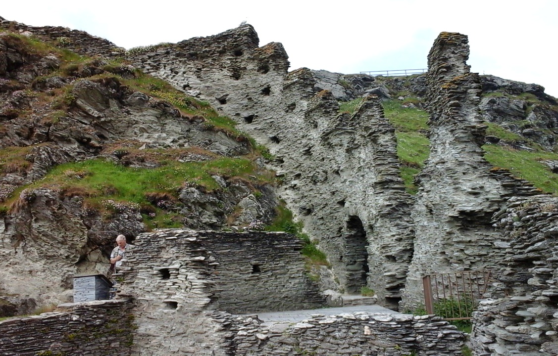
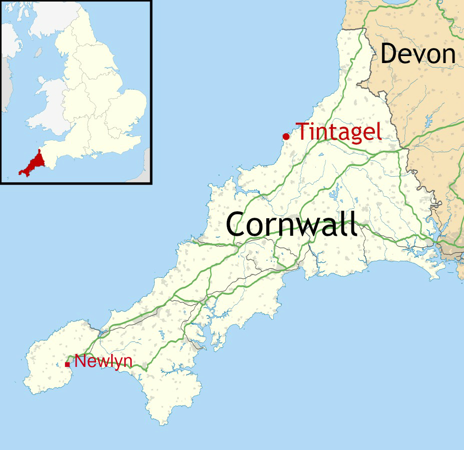
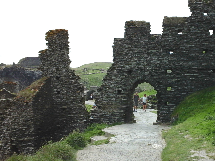
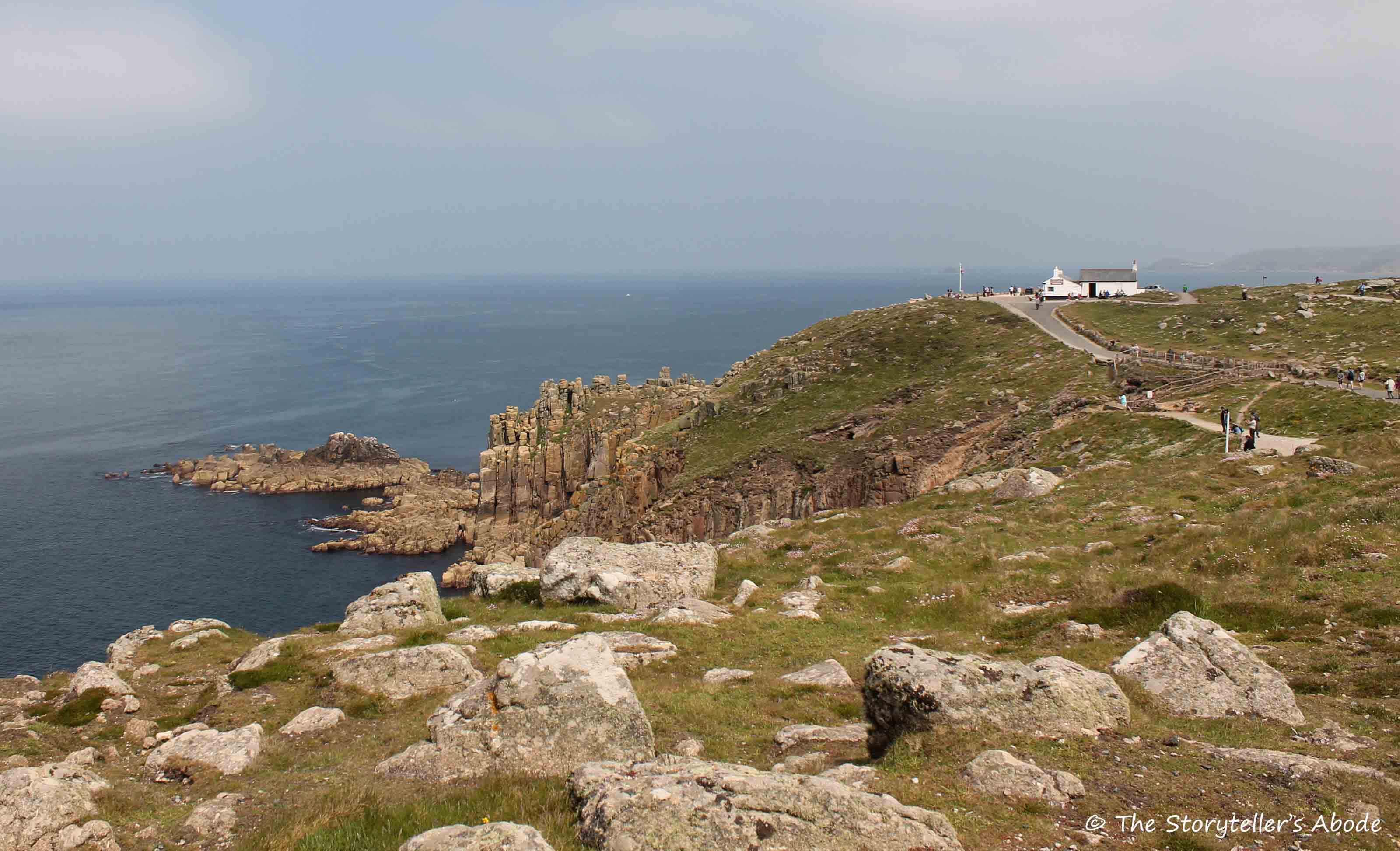
We visited the Lost Gardens of Heligan in the afternoon of the second day of our holiday in Cornwall in June 2016. After spending a full Monday morning and early afternoon at Tintagel (the subject of A Look at Cornwall (4)) we decided to stop off on our way back to Newlyn for a quick look round this fabulous site. It was a gloriously sunny afternoon and we could have done with many more hours there.

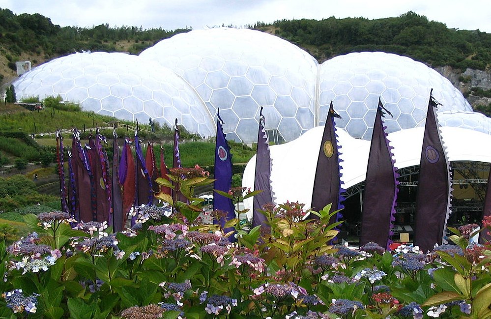
This map shows where Heligan is located in Cornwall. (X marks the spot). The site is a mile and a half from Mevagissey and six miles from St. Austell. It’s also only ten miles from another famous Cornish attraction, The Eden Project – which we haven’t visited since 2003.

X marks the approximate location of the Lost Gardens of Heligan, near Mevagissey, Cornwall UK

There are many wonderful gardens in Cornwall, all of them well worth a visit, but as the name suggests, the Lost Gardens of Heligan are particularly special. Not only are they amongst Cornwall’s finest gardens but – as you might guess – the word ‘Lost’ is the reason why they’re special. The story of how they were ‘found’ again – in other words, restored – is interesting as well as being an incredible feat.

At Heligan today there are over 200 acres of Victorian walled gardens, working buildings including bothies, a potting shed and a tool shed. There are exotic glasshouses, pleasure gardens, lawns, lakes and ponds and many acres of orchard as well as a farm (Home Farm, where lovely old breeds of cattle, sheep and pigs are reared) 22 acres of subtropical jungle and a 30 acre ‘Lost Valley’. But for many years following WWI, the beautiful gardens lay neglected and overgrown, the glasshouses broken and useless. So what is the story behind all this?

Heligan House was built by William Tremayne in 1603. It was the home of the Tremayne family who controlled over 1000 acres in the area. It is still privately owned and not open to the public.

Heligan House. The house is in private occupation and not open to the public. Source: geograph.org.uk Author: Neil Clifton. Creative Commons

Before WWI, the estate was completely self-sufficient, having its own quarries, woods, farms, a brickworks – the earliest in Cornwall – a flour mill, sawmill, brewery and productive orchards and gardens. Apart from luxury goods, the only imports were lime for fertilisers and coal for heating.

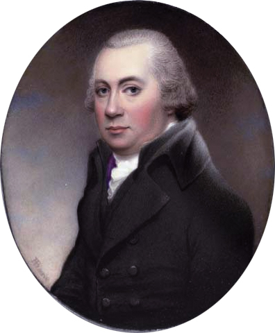
Most of the gardens and ornamental woodlands were created during the 19th century by the successive efforts of Henry Hawkins Tremayne, John Tremayne and John Claude Tremayne, all noted botanists and horticulturalists.

Henry Hawkins Tremayne (1766-1829) in black coat and waistcoat with aubergine lining, white coat, powdered hair. Source: Christies. Author: Henry Bone (1755-1834) Public Domain

By 1900 they had amassed a wonderful collection of trees and shrubs from all over the world. Follies and temples were scattered throughout and walks and rides were created. The local community depended on the estate for income: it was the centre of the community, with 20 house staff and 22 garden staff.

But the First World War changed all this, just as it did with most stately homes at that time (as shown in the fictional Downton Abbey).

In 1914, the male staff at Heligan ‘signed up’ for active service, most being sent out to the trenches on the Western Front. Heligan House was taken over by the War Office and became a convalescent home for officers. The house was returned to the family in 1919, but after the war, only 6 of the 22 garden staff returned, the rest having not survived the battles in Flanders.

The following picture is from an information board at Heligan…

…accompanied by these notes:

We know the names of 13 outdoor staff who served in World War One and have sown a field of Flanders Poppies in thankful memory of all of them, including 4 who served and returned. (Individual photos were given by relatives of those brave Heligan men.)

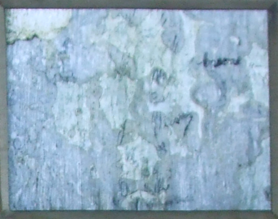
During the Second World War, the house was allocated to the US army (practice landings for D-Day took place a mile away at Pentewan Beach). The gardens remained with the Tremaynes, but for many years after the war the gardens were simply neglected, remaining in a time capsule – efectively, ‘lost’. But, in 1990, a chance meeting between John Willis, a Tremayne family member, Tim Smit (an archaeologist) and John Nelson saw the start of an amazing journey of restoration. When Smit and Nelson discovered a tiny cubicle at the bottom of a small, walled garden (since known as the Thunderbox Room – yes, the toilet) and saw the pencil signatures written on the flaking plaster walls, evoking past lives, they knew that the restoration project must be undertaken in the names of those former Heligan workers.

The Thunderbox room at Heligan (far doorway, through which the child has just emerged).
Fading, pe-WWI pencil signatures on the flaking lime walls of the ‘Thunderbox’ at Heligan. Photo from the same information board as the one of the servicemen above.

Before I share some photos of the parts of Heligan we managed to see in the short time we had, here are a few images (from information boards again) of what the site looked like in 1990, i.e. before restoration started:

And this photo shows what the head gardener’s hut looks like now, after careful restoration:

And these are the bee skeps now, on Bee Bole Lawn, which we passed on our walkabout:

In the following photos, I have tried to show things we saw along the way as we walked round. We had no particular, pre-arranged  route, and just went where the fancy took us.

This is the Entrance:

From the ticket office, we set off along the paths towards Flora’s Garden:

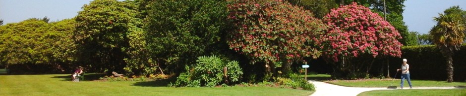
Next we spent some time investigating the different walled gardens and outhouses:

From the walled gardens we headed along the Woodland Walk, where we found some great woodland sculptures, all created by local artists.

This is my final set of photos before this post becomes ridiculously long. They are of an area of Heligan known as the Jungle. It covers an area of eight acres with what is described as ‘a watercourse’ running along the floor of the valley that links four ponds. The ‘big house’ looks down the valley, which winds its way to Mevagissey. It houses a collection of sub tropical plants and was created a hundred and fifty years ago when a craze for collecting exotic plants swept the country. Cornwall’s mild climate is ideal for such species. Visitors follow boardwalks along the valley.

Eventually we headed back to the entrance, with Louise being disappointed at not having found the one place at Heligan we all remembered from 2003. It was simply some stone steps that Louise had taken a photo of. Some years later, she created a very lovely painting (acrylic on canvas) of the image – a huge one that stands on an easel. As we got closer to the cafe and shop we saw an interesting-looking opening between some rocks and decided to investigate. And there we found the steps – which we all duly photographed again.


Although we managed to see a lot of the gardens, there were areas of the site we didn’t have time to get to – including the Lost Valley and Home Farm – so they’re now at the top of the list for our next trip down to Cornwall. And next time, we’ll get there in plenty of time to enjoy a Cornish cream tea in the cafe. On this occasion, it had already closed. 😦

A Look at Cornwall (4): The Magic of Tintagel

island-courtyard-6

On the second full day of our week in Cornwall last year – a Monday – we set off from Newlyn in the south-west of the county where we were staying, and headed north-east for 63 miles to the site of the village of Tintagel and its famous castle.

Tintagel Castle is one of the most famous historic sites in Britain and long associated with King Arthur, though its history reaches back centuries before the tales of the legendary king. The actual name, ‘Tintagel’, probably comes from the Cornish word ‘Dindagell’ or ‘Dintagel’, meaning ‘fort on the constriction’, or ‘fort on the headland’.

Tintagel sits on one of the finest sections of the Cornish Coastal Path and is built half on the mainland and half on a jagged headland or ‘island’ that projects out into the Cornish Sea. These photos, as the one directly above from an information board at the site, show the connecting bridge between the mainland and island.

We started our visit in the village of Tintagel – where most tourists park – before heading up the track for the half-mile walk towards Tintagel Head and the castle. The car park we chose was opposite a very aptly named pub, where we stopped off for coffee before setting off:

And this is the track…

This is the signpost at the bottom of the first part of the climb up to the castle. If we carry on walking past here, we come to the Beach Cafe and visitor facilities – and the sea.

Before I show a few photos of the parts of the castle we explored, here’s a little about the history of the Tintagel area.

The site of the castle has been inhabited since the Roman period and probably even earlier. There is no real evidence of an Iron Age fort, although it is believed that the site would have been similar to promontory forts on other S.W. headlands – such as at the Willapark headland a mile to the east. Nor is it known how much activity there was at the site in the Roman period. There is no evidence of Roman structures, but a few artefacts dating from the late 3rd to the early 4th century have been found, including an inscribed pillar. This was originally in the cemetery of St Materiana’s, the 11th century church in Tintagel village, but has since been taken inside the church itself. Other small finds, such as Roman coins and pottery have also been discovered in the area.

During the so-called ‘Dark Ages’ – roughly the 5th-7th centuries – Tintagel was an important and prosperous stronghold. Right across the island are the remains of rectangular houses. Fragments of glassware, wine-jars and other decorated pottery vessels have also been found, all evidence of a thriving trade with Mediterranean regions at this time. Some of these Dark Age houses can be seen in the next few photos:

There is little evidence of activity over the following 500 years. Then, in 1138, Geoffrey of Monmouth in his work, History of the Kings of Britain, linked Tintagel to King Arthur. Since the site had no military value, it seems it was this legend that inspired Richard, Earl of Cornwall, the younger brother of King Henry 111, to build Tintagel Castle here in 1230.

In the early centuries an isthmus (narrow neck of land) would have linked the mainland to the island. We know that the isthmus survived until the 12th century, as it was recorded by Geoffrey of Monmouth in the above-named book. But by the time Earl Richard was building his castle the isthmus had already partly eroded away and by 1540, the antiquary John Leland reported that the only way onto the island was by longe elme trees layde for a bryge. Today, passage between mainland and island is via the man-made, wooden bridge shown above.

And so our journey upward began…

Once we got to the top of the incline leading from the signpost on the lane, we arrived at the first part of the castle, which is on the mainland. The ticket kiosk is here and as we’re members of English Heritage we didn’t have to pay – other than the cost of the requisite Guide Book (requisite for me, that is). We didn’t stop to explore the mainland section of the castle as we were keen to get over to the island. So on we pushed towards the island, across the bridge and up dozens of steps, with my rickety knees complaining all the way.  

But the views of the sea, the beach and cliffs – not to mention, Merlin’s Cave – were worth it:

The parts of Earl Richard’s castle on the mainland include the lower and upper courtyards, or outer bailey, which has suffered greatly from erosion of the cliffs. When the castle was built in 1230, the mainland and island parts of the castle were connected by what was left of the isthmus, which had already partly eroded. Richard probably fortified this neck of land with a gatehouse and possibly some kind of drawbridge, which has now been lost as a result of landslips.

Our first stop on the island was the inner ward, or courtyard, with a great hall and chambers. Between 1240 and 1260, a curtain wall was built, forming a high, battlemented enclosure around the courtyard:

We pushed on through the gate in the curtain wall…

…and headed on up toward the top of the island:

The ruins at the top of the island date mostly from the Middle Ages. There is a well…

…and a small walled garden. The garden was first recorded in the 1540s  and excavations  in the 1930s show it was used for flower beds and herbs, although its position on the top of the island seems strange.  The garden has since become linked with the story of Tristan and Yreult/Isolde. In some versions of the myth, the lovers meet in the garden. A number of slates inside the wall, tell part of the story. Unfortunately, the light on some of them make them difficult to read:

Further on, close to the edge of the cliffs, we came to the statue of the warrior (King Arthur?):

And to finish off, here are a few photos of the views from up there:

***

References:

Guide Book and leaflets from Tintagel Castle

Wikipedia

English Heritage: http://www.english-heritage.org.uk/visit/places/tintagel-castle/

A Look at Cornwall (2): Land’s End

cornish-lands-end

Land’s End – or Penn an Wlas in Cornish – was the second site we visited in the far south-west of Cornwall on the first full day of our holiday. It’s located 8 miles west of Penzance at the end of the A30, a road notorious for its traffic jams throughout the summer due to the thousands of tourists, and is in the village and parish of Sennen.

location-of-lands-end-in-the-penwith-peninsulaPeal Point/Land’s End is the most westerly point in Britain, and the area boasts some of the country’s most beautiful natural coastline. Stunning 200 feet high cliffs are still carved out by huge Atlantic waves and views are magnificent in both directions along the coast as well as out to sea. Seabirds circle above and the area has become legendary as a place for bird watching. Gannets, fulmars, kittiwakes, shags, razorbills and even Cornish choughs (pronounced ‘chuffs’) once extinct in Cornwall, are making a welcome come-back.

These are a couple of worse-for-wear information boards about the bird and sea life of the area.

Land’s End and John o’ Groats in the far north-east of Scotland, have become renowned as the two extremities of Britain, as this map from Wikipedia shows:

map-showong-lands-end-to-john-o-groats

These are the signposts at Land’s End and John o’Groats. Both images are from Wikipedia. We couldn’t get near the one at Land’s End to get a decent photo because of the queues of people waiting for the professional photographer to snap them all, smiling nicely beside the famous signpost (at £10 a time).

The route of 874 miles has often been travelled by walkers and/or cyclists, either as individuals or in small groups and for a variety of reasons. For some it has been a matter of personal achievement, whereas others, often well known personalities, have undertaken the route as a means of raising money for charity – as cricketer, Ian Botham, did in 1985, and the terminally ill cancer sufferer, Jane Tomlinson did in 2003. The first recorded walk of the route was in 1871 by the brothers John and Robert Naylor.

I must admit, on arrival at the Centre we were quite surprised. Having never been to Land’s End before we expected to see just views of the renowned landmark. What we found was a collection of buildings including several ‘eateries’, shops and a list of interactive entertainments that take place throughout the spring and summer months – including a fireworks display, Pirates Day and so on. Naturally, these are aimed at families with children which, I suppose, sounds sensible. Most children would soon get bored just walking around with parents simply taking photographs. But a few reviews on the online sites I checked include criticisms of the place having become ‘more like a theme park’ than a beauty spot. It’s free to enter the Visitor Centre, but there are extra costs for the ‘extras’.

These photos are of the outside, apart from the cafe. We didn’t bother looking round the souvenir shops:

The Visitor Centre itself doesn’t sit on the site of the actual point of Land’s End. That’s a little further along, northwards, and is also known as Peal Point. It can be seen in the first photo below:

Just over a mile offshore and visible from the headland is a group of islets called the Longships. How dangerous these were to shipping in the past is evident in the need for a lighthouse. Together with the Seven Stones Reef and the Isles of Scilly, 28 miles to the south-east, these islets form part of the mythical lost land of Lyonesse in the Arthurian legends.

Since Norman times (1066 0nwards) a number of custodians have looked after Land’s End, and it is currently owned by a private company called Heritage Attractions/Heritagegb. This legendary Cornish destination has inspired people since Greek times, when (according to an information leaflet from the site) it was known as Belerion – the shining land.  The whole area is steeped in history and people have travelled to, and been living here, for at least 10 thousand years. The granitic lands away from the coast are home to a Neolithic (Stone Age) cemetery. Bronze Age burial mounds and an Iron Age hill fort can be found within 200 yards of Land’s End.

looking-inland-at-lands-end

In the early 19th century, it was to The First and Last Inn, just a mile away from Land’s End that travellers in their coaches would stop for food and rest before continuing on to the famous landmark on foot or horseback. We passed it, just before reaching the Centre, but didn’t think to take any photos. It could well be the distant white building on the photo above, though I can’t be sure. But the inn is somewhere over in that direction – and is still open today. The Inn is one of the most famous in Cornwall and not only because of its location. It has had a notorious reputation since the 1600s of being the headquarters of smugglers and wreckers.

Nowadays visitors to Land’s End are more likely to walk to the building shown on my featured image and the photo below for refreshment. If they continue along the coastal path, past the actual point of Land’s End, they will come to a building called ‘The First And Last House‘.

most-westerly-point-in-englandThis was originally opened by Gracie Thomas who served travellers to Land’s End with food and drink, as well as a piece of local granite as a souvenir. Today, gifts, toys and refreshments are still offered here, as well as Cornish ice cream.

By the time we left Land’s End, having previously spent a long time at Carn Euny, it was well past lunchtime. So we headed northward towards St Just to have something to eat before we all starved to death. Then we continued on to seaside town of St Ives – which I’ll post about next.

*****************

Fancy a Cornish Pasty . . . ?

Cornish pasties at Cornish bakehouse
Cornish Pasties at a Cornish bakehouse. Author Gvjekoslav. Creative Commons

This past week, Nick and I have been down in Cornwall, along with our blogging daughter Louise (thestorytellersabode). We both intend to post about some of the great sites we’ve visited down here once we get home but for now, I just want to say a few words about this lovely county and share a few photos of the main images of the place.

I also want to say a big ‘Thank You’ to staunch Cornishman  and fellow blogger draliman for meeting up with us and having a lovely chat and evening meal. It was really nice, as both Lou and I have laughed our heads off at some of Ali’s hilarious stories for months. It was just a pity we didn’t think to take any photos.

Cornwall – or Kernow, as it’s known to the Cornish people – is situated in the far south-west of the United Kingdom:

Cornwall_UK_locator_map_2010.svg
Location of Cornwall. Source: O.S. Survey Opendata. Author: Nilfanion. Creative Commons

The region has been inhabited since the Paleolithic (or Stone Age, dating from 2.5 million – 20,000 years ago) and Mesolithic periods, through the Neolithic and Bronze age, and eventually the Iron Ages (around 800 BC onwards). At this time, Cornwall, like all of Britain south of the Firth of Forth, was inhabited by a Celtic people known as the Britons. Cornwall itself was home to a tribe of Britons known as the Dumnonii.

England_Celtic_tribes_-_South
Image depicting the Celts of South England pre-Roman Britain times. Author: Yorkshirian at English Wikipedia. Creative Commons

There is little evidence of Roman rule west of Exeter in neighbouring Devon, and later on, in the 9th century, Cornwall often came into conflict with the expanding Anglo Saxon kingdom of Wessex.

For many people from other parts of the UK, Cornwall can seem a rather distant county, one popular with holidaymakers, who all have different images of what the county looks like, or is like in everyday life. The word ‘Cornish’ alone can conjure up many different images. Here are just some of them:

1. Picturesque fishing villages and harbours

2. Old tin mines (as in ‘Poldark’) and later on, copper mines as well

3. China clay (kaolin) mines

4. Lovely beaches, surfers and steep, rocky coasts with caves – and smugglers (as in ‘Jamaica Inn’ and ‘Poldark’).

5. Cornish Pasties, Cornish ice cream and Cornish cream teas (all very yummy!)

Cornish cream tea
Cornish Cream Tea at Boscastle, prepared in the Devonshire Method. Author: Tuxraider, reloaded at English Wikimedia. GNU Free Documentation License.

6. Iron age villages sites,  standing stones and barrows

7. Tintagel – legendary castle of King Arthur and the Knights of the Round Table

8. Saint Michael’s Mount – island and castle at the end of a ‘sometime’ causeway

9. Beautiful gardens

10. Penzance – a town associated with the opera, ‘The Pirates of Penzance’

11. Nice warm (but sometimes wet) summers and mild winters

12. Moorlands (like Bodmin Moor) and granite tors

13.  The Eden Project. We visited this site some years ago (2003) so haven’t any photos on this occasion. So here’s a picture from Wikipedia:

Eden Project near St. Austell, Cornwall UK.
The Eden Project, established in 2,000 in Cornwall, England. A modern, botanical garden, exploring the theme of sustainability. Author: A 1 personage at en,wikipedia. Public Domain

So, until I post about some of these places in more detail, here are a few photos, giving a  further glimpse of this beautiful and unique county: