
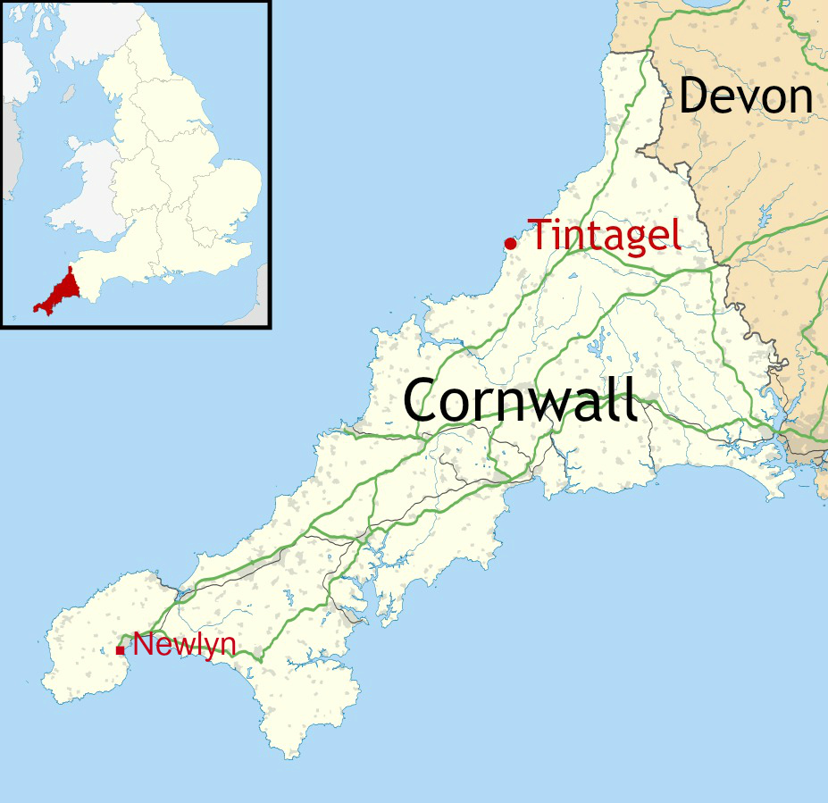
On the second full day of our week in Cornwall last year – a Monday – we set off from Newlyn in the south-west of the county where we were staying, and headed north-east for 63 miles to the site of the village of Tintagel and its famous castle.
Tintagel Castle is one of the most famous historic sites in Britain and long associated with King Arthur, though its history reaches back centuries before the tales of the legendary king. The actual name, ‘Tintagel’, probably comes from the Cornish word ‘Dindagell’ or ‘Dintagel’, meaning ‘fort on the constriction’, or ‘fort on the headland’.
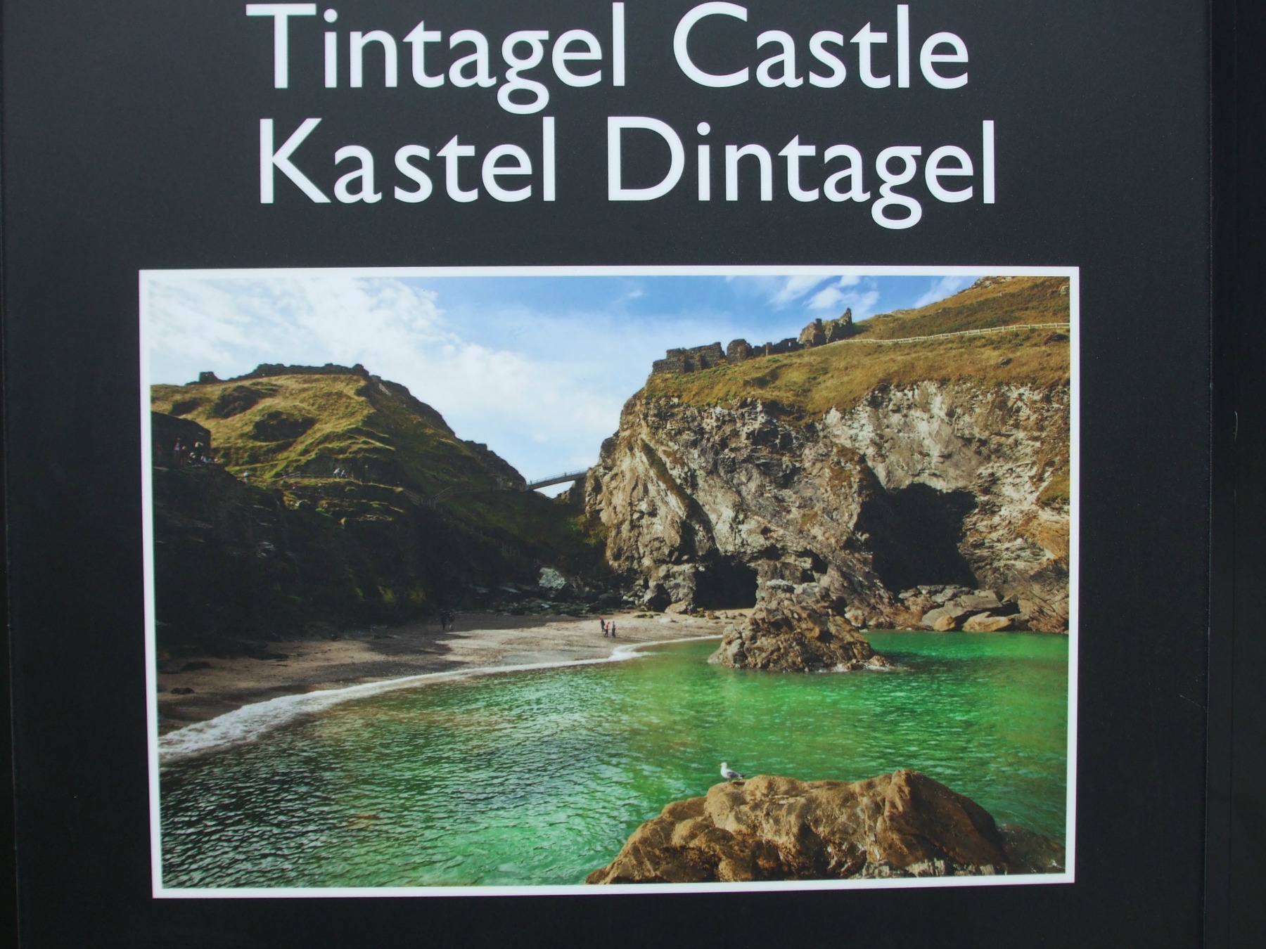
Tintagel sits on one of the finest sections of the Cornish Coastal Path and is built half on the mainland and half on a jagged headland or ‘island’ that projects out into the Cornish Sea. These photos, as the one directly above from an information board at the site, show the connecting bridge between the mainland and island.


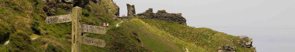
We started our visit in the village of Tintagel – where most tourists park – before heading up the track for the half-mile walk towards Tintagel Head and the castle. The car park we chose was opposite a very aptly named pub, where we stopped off for coffee before setting off:

And this is the track…


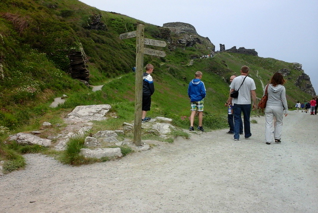
This is the signpost at the bottom of the first part of the climb up to the castle. If we carry on walking past here, we come to the Beach Cafe and visitor facilities – and the sea.
Before I show a few photos of the parts of the castle we explored, here’s a little about the history of the Tintagel area.
The site of the castle has been inhabited since the Roman period and probably even earlier. There is no real evidence of an Iron Age fort, although it is believed that the site would have been similar to promontory forts on other S.W. headlands – such as at the Willapark headland a mile to the east. Nor is it known how much activity there was at the site in the Roman period. There is no evidence of Roman structures, but a few artefacts dating from the late 3rd to the early 4th century have been found, including an inscribed pillar. This was originally in the cemetery of St Materiana’s, the 11th century church in Tintagel village, but has since been taken inside the church itself. Other small finds, such as Roman coins and pottery have also been discovered in the area.

")
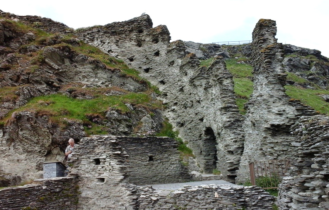
During the so-called ‘Dark Ages’ – roughly the 5th-7th centuries – Tintagel was an important and prosperous stronghold. Right across the island are the remains of rectangular houses. Fragments of glassware, wine-jars and other decorated pottery vessels have also been found, all evidence of a thriving trade with Mediterranean regions at this time. Some of these Dark Age houses can be seen in the next few photos:


There is little evidence of activity over the following 500 years. Then, in 1138, Geoffrey of Monmouth in his work, History of the Kings of Britain, linked Tintagel to King Arthur. Since the site had no military value, it seems it was this legend that inspired Richard, Earl of Cornwall, the younger brother of King Henry 111, to build Tintagel Castle here in 1230.
In the early centuries an isthmus (narrow neck of land) would have linked the mainland to the island. We know that the isthmus survived until the 12th century, as it was recorded by Geoffrey of Monmouth in the above-named book. But by the time Earl Richard was building his castle the isthmus had already partly eroded away and by 1540, the antiquary John Leland reported that the only way onto the island was by longe elme trees layde for a bryge. Today, passage between mainland and island is via the man-made, wooden bridge shown above.
And so our journey upward began…
Once we got to the top of the incline leading from the signpost on the lane, we arrived at the first part of the castle, which is on the mainland. The ticket kiosk is here and as we’re members of English Heritage we didn’t have to pay – other than the cost of the requisite Guide Book (requisite for me, that is). We didn’t stop to explore the mainland section of the castle as we were keen to get over to the island. So on we pushed towards the island, across the bridge and up dozens of steps, with my rickety knees complaining all the way.


But the views of the sea, the beach and cliffs – not to mention, Merlin’s Cave – were worth it:


The parts of Earl Richard’s castle on the mainland include the lower and upper courtyards, or outer bailey, which has suffered greatly from erosion of the cliffs. When the castle was built in 1230, the mainland and island parts of the castle were connected by what was left of the isthmus, which had already partly eroded. Richard probably fortified this neck of land with a gatehouse and possibly some kind of drawbridge, which has now been lost as a result of landslips.
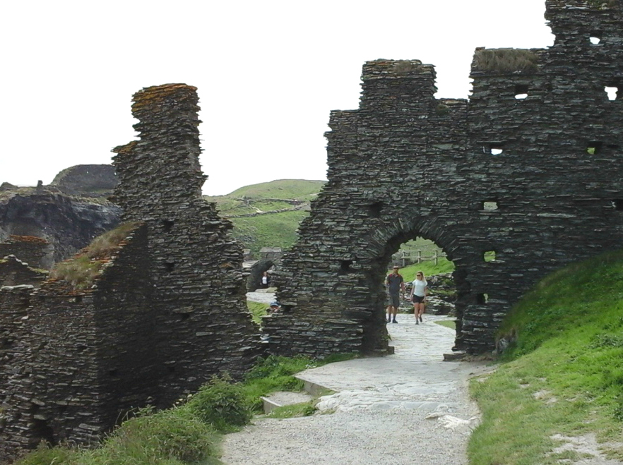
Our first stop on the island was the inner ward, or courtyard, with a great hall and chambers. Between 1240 and 1260, a curtain wall was built, forming a high, battlemented enclosure around the courtyard:


We pushed on through the gate in the curtain wall…
…and headed on up toward the top of the island:


The ruins at the top of the island date mostly from the Middle Ages. There is a well…

…and a small walled garden. The garden was first recorded in the 1540s and excavations in the 1930s show it was used for flower beds and herbs, although its position on the top of the island seems strange. The garden has since become linked with the story of Tristan and Yreult/Isolde. In some versions of the myth, the lovers meet in the garden. A number of slates inside the wall, tell part of the story. Unfortunately, the light on some of them make them difficult to read:


Further on, close to the edge of the cliffs, we came to the statue of the warrior (King Arthur?):


And to finish off, here are a few photos of the views from up there:


***
References:
Guide Book and leaflets from Tintagel Castle
Wikipedia
English Heritage: http://www.english-heritage.org.uk/visit/places/tintagel-castle/
