Happy Father’s Day 2016

shutterstock_417902566

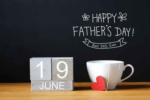
I’m sure I don’t need to remind anyone that today is Father’s Day in many countries around the world. Many of us will have been out there this past week, hunting around the shops for gifts or making last-minute bookings at restaurants and such like. Well, this year, we’re all heading out for an evening meal in Lincoln. Our youngest son is once again abroad – for work! – this time in sunny Antigua, so he’ll be missed, yet again.  😦

Last year I wrote about the various customs attached to this day, and how it all started over there in the U.S. so, as nothing has changed about that, I thought I’d just repost it, with a few words more relevant to this year.

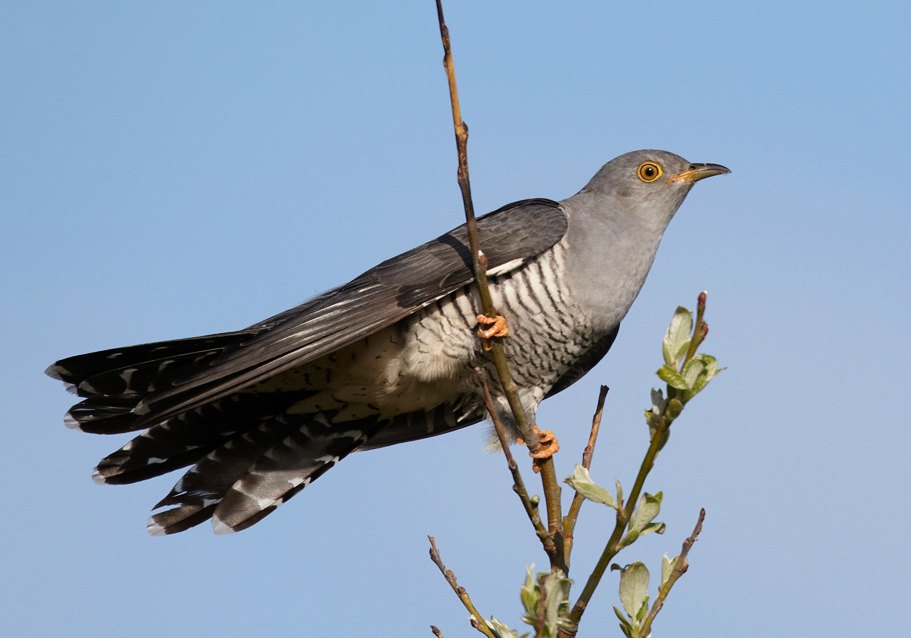
This image, courtesy of Pixabay, is particularly applicable to my husband, who was a motorbike fanatic in his youth – thankfully, before I met him!

happy-fathers-day-1456605_640

In the United Kingdom, Father’s Day is celebrated on the third Sunday of June, in keeping with the United States, where the custom originated, and many other parts of the world. This is in contrast to Mothers’ Day, which has a very different history in the U.S. and the U.K. (Happy Mother’s Day) and is celebrated on different dates.

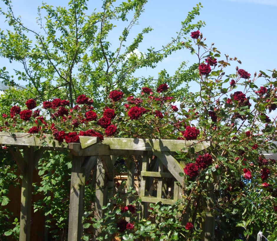
Father’s Day is a day to honour fathers and father figures, including grandfathers and fathers-in-law. Many people make a special effort to visit their fathers or to send them a card or gifts. As for Mothers’ Day in Britain, children spend time making their own cards, and gifts tend to be similar to those many dads get for Christmas – socks, slippers, ties, items of clothing or perhaps a mug with a slogan like ‘The World’s Best Dad’ or simply ‘Dad’ written on it. T-shirts, mouse mats, bags and T-shirts with photographs of the children printed on them are also reasonably popular. As for giving flowers, in the U.S. fathers were traditionally given the gift of white or red roses. The rose is the official flower for Father’s Day.

shutterstock_141520969

Wearing a red rose signifies a living father, while a white one represents a deceased father. I haven’t heard of roses being given here in the U.K. but that doesn’t mean the custom isn’t observed at all.

For some dads in the U.K. Father’s Day can be a day for being taken out and treated to a pint or two down at the pub. Some families make more of things and the ‘treat’ could be a meal out somewhere special, or one of the popular ‘Father’s Day’ experiences, like driving a rally car, tank, fire engine, or even an aeroplane. Some children pay for Dad to have a golf, football or cricket lesson with a celebrity coach.

A father holding a necktie cookie on Father's Day. Author: Dean Michaud, originally posted on Flickr, terms compatible with Commons.
A father holding a necktie cookie on Father’s Day. Author: Dean Michaud, originally posted on Flickr, terms compatible with Commons.

There are two versions regarding the origins of Father’s Day in the United States. Some people maintain that it was first introduced in 1910 by a woman called Sonora Smart Dodd who was inspired by the work of Anna Jarvis, the woman who had pushed for Mother’s Day celebrations. Sonora’s father raised six children by himself after the death of their mother, which was uncommon at that time, as many widowers placed their children in the care of others or quickly married again. So Sonora felt that her father deserved recognition for what he’d done. The first Father’s Day was held in June 1910, and was officially recognised as a holiday in 1972 by President Nixon.

Sonora Smart Dodd. Image from Wikipedia.

Others in the U.S. say that Grace Golden Clayton from Fairmont, West Virginia, should be credited with the idea of Father’s Day, after she suggested a day to celebrate fatherhood in 1908, following the anguish of the Monongah mine disaster in December 1907. Officially, 362 men died, in that disaster, 250 of them fathers, leaving more than a thousand children without a dad. It was America’s worst mining ­accident. Most of the men were Italian migrants and the actual death toll is estimated at nearer 500.

Grace Golden Clayton, whose father was killed in the tragedy, suggested a service of commemoration for this lost generation to the pastor of her local Methodist chapel, and the first Father’s Day took place on July 5, 1908. But Grace’s idea didn’t spread outside this isolated mining settlement. It took off two years later, after Sonora Smart Dodd’s campaign – only to fall into disuse soon after until the 1930s, when it slowly gained official recognition. President Richard Nixon proclaimed it a national holiday in 1972.

I must confess that until I looked this up last year, I didn’t know the origins of Father’s Day in the U.S. I knew the custom started in America but, like many other people, I assumed it was either another money making racket on behalf of the gift and card industry, or a way of keeping things equal with Mother’s Day – which is partly true.

In our house, the children usually come round with presents around lunchtime. The usual gifts from our sons is some type of malt whisky, although there will often be a box of chocolates as well. The girls, Louise and Nicola, tend to go for something from the Garden Centre – or vouchers for him to spend there, as he’s an avid gardener. Our youngest son, who works in various places abroad, generally sends some kind of plant via Interflora or suchlike. We have lots of  plants and flower in our garden that started life in wicker baskets, and they’re doing very nicely.

One last note or two…

In Germany, Father’s Day (Vatertag) or Men’s Day (Männertag)  is celebrated differently from other parts of the world. Groups of men go off into the woods with a wagon of beer, wines and meats. Heavy drinking is common on that day and traffic accidents tend to rise, causing police and emergency services to be on high alert. Some right-wing and feminist groups have asked for the banning of the holiday. Father’s day with a kick, I’d say!

A Hiking Tour on Father’s Day. Author: Steffen Gebbhart at Wikimedia. Public Domain

In China, Father’s Day used to be on August 8. This was because the Chinese word for 8 is ‘ba’ and the colloquial word for father is ‘ba-ba’. It has now been moved to the third week in June to keep in line with other countries.

Refs:

http://www.findmeagift.co.uk/fathers-day-gifts/history.html

https://en.wikipedia.org/wiki/Father%27s_Day

The Cheddar Gorge

Along the Gorge ABefore I plunge into writing up some posts about Cornwall from our holiday last week, I thought I’d better finish off some of the ones I still have to do from our stay in Somerset a few weeks’ ago. (Too many holidays to keep up with at the moment!) This post is about one of the sites we’d been intending to visit for years – and I’m very glad we eventually made it there. Oddly enough, at the mention of the Cheddar Gorge, most people’s minds turn to cheese. And rightly so.

The Cheddar Gorge is the largest gorge in England and is located on the southern edge of the Mendip Hills near to the village of Cheddar in Somerset. (x marks the spot!)

Location of the county of Somerset. Source; Ordnance Survey OpenData. Author: Nilfanion. Creative Commons

The Gorge’s limestone cliffs rise to 450 feet and the scenery along it is quite beautiful, as well as dramatic. It is an Area of Outstanding Natural Beauty (AONB) and part of a Site of Special Scientific Interest (SSSI). It has been inhabited since the end of the last Ice Age and today, visitors come from all over the world simply to admire the scenery, climb the near-vertical cliffs or cycle along the steep gradients of the road that runs through it (the B1315). Cavers come to explore the many caves, the two largest of which are stalactite caverns and open to the general public.

This handsome, 9,000-year-old chap can be seen in Gough’s Cavern (he’s not a real skeleton, of course – just a replica. :)) His name is Cheddar Man, whose real skeleton was found in this cave in 1903. I’ll be writing about the two caves in my next post.

Gough's Cave 1 ++

Ownership of the Gorge is shared by two parties. The south side (where most of the visitor attractions, including the two caves and several tea rooms and cafés, are) is owned and administered by the Marquess of Bath’s Longleat Estate. The north side, where the striking rocks of the Gorge tower alongside the road, is owned by the National Trust.

Here’s a very simple description from AboutBritain.com of how the Gorge was formed:

The Gorge was formed about three million years ago when a small river cut through the soft limestone. Thaws of subsequent ice ages increased the flow at times to produce this spectacular natural attraction. You can still see the benign-looking river which now flows underground and appears at the foot of the Gorge.

On arrival at the site, we decided to do what many visitors do, and take an open-top bus ride trough the gorge.  So we headed for the car park to wait for the bus, which runs back and forth quite frequently.

Car park for catching Gorge tour bus +

Naturally, this guided tour isn’t free, but the cost does include entry to the two caves and the little museum as well. The bus turns around at a point a short distance past the touristy area, and allows us to see the stunning Gorge cliff s without the shops and other buildings. At that point, we got off the bus to walk back, visit the caves and generally enjoy the attractions on offer.

These are just a few of the photos we took from the bus. I bet you can’t miss the friendly lion:

Wildlife in the Gorge includes dormice, yellow-necked mice, slow worms, adders and rare blue butterflies. Many bats inhabit the caves and on the rocky slopes, goats can just be seen (if your eyesight is good!). The ones we spotted were too distant to see clearly:

Cheddar Gorge Goats 1

So here’s a close up picture from Wikipedia:

Cheddar Gorge goat 1

The goats have been  introduced as part of a programme to encourage the biodiversity of the area. A flock of feral sheep also graze the slopes. There are also many species if birds, including peregrine falcons, kestrels and buzzards and too many species of flora to mention, other than to say that many are chalk grassland-loving species.

We had lunch at one of the many ‘eateries’ . . .

Wishing Well Tea Room (View from road 3 +. . . and in the afternoon, we headed up Jacob’s Ladder. This is a series of 274 steps which takes visitors up to a stunning cliff-top walk:

Jacob'sLadder 2

The clifftop walk is three-miles long and there are excellent views of the Gorge as well as further afield from up there. There is also an observation tower (more steps for my knees to complain about) with 360 degree views. Here are a few of the photos we took from the clifftop. Not all are from the observation tower:

To finish off with, here are just some of the many things to see as you walk along the road:

And, really, really finally this time, a quick word about cheese. 🙂

The village of Cheddar is the home of the original Cheddar cheese. It has been produced here since at least the 15th century (earliest mention of Cheddar cheese in 1170) and left to mature in the caves, with their cool and constant temperatures. The Cheddar Gorge Cheese Company, unsurprisingly, is located further along the Gorge than we went, and cheeses can still be seen today, maturing inside Gough’s Cavern. Now, Cheddar cheese is made all over the world. And I’m not surprised at that because it’s very yummy!

Fancy a Cornish Pasty . . . ?

Cornish pasties at Cornish bakehouse
Cornish Pasties at a Cornish bakehouse. Author Gvjekoslav. Creative Commons

This past week, Nick and I have been down in Cornwall, along with our blogging daughter Louise (thestorytellersabode). We both intend to post about some of the great sites we’ve visited down here once we get home but for now, I just want to say a few words about this lovely county and share a few photos of the main images of the place.

I also want to say a big ‘Thank You’ to staunch Cornishman  and fellow blogger draliman for meeting up with us and having a lovely chat and evening meal. It was really nice, as both Lou and I have laughed our heads off at some of Ali’s hilarious stories for months. It was just a pity we didn’t think to take any photos.

Cornwall – or Kernow, as it’s known to the Cornish people – is situated in the far south-west of the United Kingdom:

Cornwall_UK_locator_map_2010.svg
Location of Cornwall. Source: O.S. Survey Opendata. Author: Nilfanion. Creative Commons

The region has been inhabited since the Paleolithic (or Stone Age, dating from 2.5 million – 20,000 years ago) and Mesolithic periods, through the Neolithic and Bronze age, and eventually the Iron Ages (around 800 BC onwards). At this time, Cornwall, like all of Britain south of the Firth of Forth, was inhabited by a Celtic people known as the Britons. Cornwall itself was home to a tribe of Britons known as the Dumnonii.

England_Celtic_tribes_-_South
Image depicting the Celts of South England pre-Roman Britain times. Author: Yorkshirian at English Wikipedia. Creative Commons

There is little evidence of Roman rule west of Exeter in neighbouring Devon, and later on, in the 9th century, Cornwall often came into conflict with the expanding Anglo Saxon kingdom of Wessex.

For many people from other parts of the UK, Cornwall can seem a rather distant county, one popular with holidaymakers, who all have different images of what the county looks like, or is like in everyday life. The word ‘Cornish’ alone can conjure up many different images. Here are just some of them:

1. Picturesque fishing villages and harbours

2. Old tin mines (as in ‘Poldark’) and later on, copper mines as well

3. China clay (kaolin) mines

4. Lovely beaches, surfers and steep, rocky coasts with caves – and smugglers (as in ‘Jamaica Inn’ and ‘Poldark’).

5. Cornish Pasties, Cornish ice cream and Cornish cream teas (all very yummy!)

Cornish cream tea
Cornish Cream Tea at Boscastle, prepared in the Devonshire Method. Author: Tuxraider, reloaded at English Wikimedia. GNU Free Documentation License.

6. Iron age villages sites,  standing stones and barrows

7. Tintagel – legendary castle of King Arthur and the Knights of the Round Table

8. Saint Michael’s Mount – island and castle at the end of a ‘sometime’ causeway

9. Beautiful gardens

10. Penzance – a town associated with the opera, ‘The Pirates of Penzance’

11. Nice warm (but sometimes wet) summers and mild winters

12. Moorlands (like Bodmin Moor) and granite tors

13.  The Eden Project. We visited this site some years ago (2003) so haven’t any photos on this occasion. So here’s a picture from Wikipedia:

Eden Project near St. Austell, Cornwall UK.
The Eden Project, established in 2,000 in Cornwall, England. A modern, botanical garden, exploring the theme of sustainability. Author: A 1 personage at en,wikipedia. Public Domain

So, until I post about some of these places in more detail, here are a few photos, giving a  further glimpse of this beautiful and unique county:

Sherwood Through the Ages

King John's Camp ++

This is my second post about our visit to Sherwood Forest last Monday, which was mostly to enjoy the many encampments and historical reenactments there over the Bank Holiday weekend. I’d intended to do just a single post, but found that one would have been far too long. So in the first post I wrote about Sherwood Forest itself and its connections to the legendary Robin Hood.

Today, I’d like to share some of the photos of the events from this fun-filled day. The event itself was called ‘Sherwood Through the Ages’ and if you’d like to see some much better photos than mine, hop over to my daughter, Louise’s post at thestorytellersabode. Reenactment groups from several historical periods between the 12th century and the 1980s were present, as well as the odd tent with items of clothing and other period items:

The different encampments  were spread out along the main pathways so they couldn’t be missed. There were interesting things to see all day, including demonstrations  of skills and reenactments of events. But even whilst the reenactors were in their camps and carrying on their roles, they were happy to interact with visitors, answer questions and demonstrate the use of weapons and equipment.

Amongst the encampments we saw were the Bowden Retinue, a medieval group whose main theme was that of escorting ‘the lady’ on her journey, and ensuring her comfort at ever stage. This group put on a demonstration of archery which, unfortunately we mostly missed, except for the very end, when they were collecting up their arrows!

Bowden Retinue Collecting Arrows =

Other medieval groups included the ‘Crusader’ camp of King John and his knights – which also included Robin Hood and his Merry Men, the Hospitaller Knights of St. John and even a few unfortunates who had returned from the Crusades with leprosy . . .

. . . and the camp of the Wars of the Roses troop (15th century):

Reenactment groups from later historical periods included the Redcoat Scots and Jacobites (1745):

. . . and the Highwaymen who preyed on unfortunate travellers on their journey along the Great North Road as it passed through the heart of Sherwood Forest ((17th-18th centuries):

Jumping to the 20th century, we have a group of British soldiers from WW1:

WW1 Forces A

And bringing us up to more recent times was a group of British soldiers from the 1980s:

To finish with, here are just three of the short videos we made. The first two show King John’s attempts to find a champion who was good enough to go after the ‘villainous’ outlaw Robin Hood. Several pairs of knights come head to head, and this is one of them:

And in this short video, Robert of Loxley (aka Robin Hood) – who had just stolen the Sheriff of Nottingham’s armour in order to compete – takes on the unpopular Sir Guy of Gisbourne:

The Scots Redcoats and Highland Jacobites entertained us with two reenactments during the day. One involved demonstrating how a man’s honour was satisfied by duelling. We didn’t film this, but here are a couple of photos of this event:

In this video, the Jacobites are ready and waiting to fight the approaching Redcoat Scots:

*****

A Day at Sherwood Forest

Robin Hood and Little John 2+

Last Monday was a Bank Holiday in the UK and Nick and I, with our two daughters, Nicola and Louise, and grandson, Kieran, headed off to Sherwood Forest – about 27 miles away from where we live. Several events and activities are held at Sherwood during the year, some with historical themes, others with environmental or conservational ones. This weekend’s events were all distinctly historical, involving encampments and displays, and a number of short re-enactments from various groups. But I can’t bring myself to write a post about the events without first adding some information about this lovely forest – or what’s left of it – today.

Sherwood Forest is located at Edwinstowe in the county of Nottinghamshire, 17 miles north of Nottingham. It was once an area of woodland and heath that covered 100,000 acres (156 square miles), amounting to one fifth of Nottinghamshire. It was first established as a royal hunting preserve in the 10th century, the remnants of which later became known as Birklands (originally burchlands) – so named after the birch trees growing there.

This map from Wikipedia shows the locations of some of the major royal forests in 13th century England:

Royal.Forests Map
Royal Forests 1327-1336 (names of selected forests). Based on I.G. Simmons’ ‘The Moorlands of England and Wales). Author: Own Work, ISBN 074860

Throughout the centuries, these expanses of forest became dangerous places to enter. Not only were wild boar living in there, but outlaws gathered in their depths to keep out of the way of capture – which would mean hanging, or mutilation of some sort, for their crimes. (The word, ‘outlaw’ is simply derived from the idea of people living ‘outside the law’.)

The Great North Road (the main London-Scotland road) ran through Sherwood Forest and control of it during the Civil War became imperative to both sides. Later, in the 18th and 19th centuries in particular, highwaymen hid in the trees, waiting for travellers and making it a perilous route. (One of the encampments over the weekend belonged to a gang of highwaymen.)

Sherwood Forest is now a 450 acre Country Park, with a fascinating ecosystem – and a host of environmental/protected site designations. It is a Grade 1 site for ancient woodland and heathland, an SSSI (Site of Special Scientific Interest) an NRA (National Nature Reserve) and an SAC (Special Area of Conservation). Entry to Sherwood Forest is free, but there is a car parking fee of £3 – which can be reclaimed on purchase in the café or in the visitor centre/gift shop (where you can buy a great bow and arrow to play with or a nice green hat with a feather in it to wear.)

Sherwood Forest is best known for its associations with one of the best known outlaws of medieval times: Robin Hood (or Robin Hode) . . .

Statue of Robin Hood +

Robin Hood/Robert of Loxley was a late-12th century outlaw who ‘robbed the rich to give to the poor’. Actually who this character was has been the subject of many long debates. He has been linked to the Green Man, Jack of the Green and Herne the Hunter (who could be all the same character) amongst others, and I do intend to do a post about all this at some stage. Robin’s story has been changed and added to over the centuries, but the basic storyline stays the same. It has become particularly well-known over the last century due to the many films and TV series about him. At the exit to the Robin Hood Exhibition there is a wall display showing some of these productions:

Film and Tv productions of 'Robin Hood' 3

And these are just a few of the scenes actually inside the Exhibition:

Sherwood attracts between 360, 000 and one million visitors per year, many of them from other countries. Each year, the reserve hosts the week-long Robin Hood Festival – a great event with a really medieval atmosphere and featuring the main characters from the Robin Hood legend. Entertainments include jousters, and players, plus a medieval encampment with jesters, musicians, rat catchers, alchemists and fire eaters.

But visitors also come to Sherwood throughout the year to visit the Forest itself. There are over 900 ‘veteran’ oak trees here, including England’s Tree of the Year for 2014, The Major Oak – which is a pedunculate or English common oak.  Naturally, other species grow here, too – birch being the predominant one. First, here are a few photos of the forest, including some of the many old oaks and some of the wood carvings dotted along the paths. I have to admit that the first tree in the gallery is my favourite. Look at those big, brawny arms – although he is rather two-faced, don’t you think . . . ?

And this is the really ‘Big Man’ of the Forest, The Major Oak:

Major Oak 2 (2) +

According to folklore, the Major Oak was Robin Hood’s principal hideout. It is believed to be between 800 and 1000 years old and since Victorian times its great, heavy boughs have been supported by elaborate scaffolding. Whether or not this tree really would have had a trunk sturdy and wide enough for a man to hide inside in the late 12th/early 13th century is debatable – but hey, this is folklore we’re talking about. There could well have been some oak old enough at the time for Robin to have hidden inside.

I’m told that clones of this awesome tree are being attempted through grafting and acorns are also being grown. Apparently, any saplings produced will be sent to various countries around the world.

Next time, I’ll post some photos of the different historical groups and characters we encountered in Sherwood on Bank Holiday Monday. It was certainly a colourful and entertaining day.

Sherwood Forest Visitor Centre 1
Sherwood Forest visitor centre sign. Author: Marcin Floryan. Creative Commons.

Stonehenge

Plan of Stonehenge (Visitor Centre) 3

During our stay in Somerset two weeks ago we also visited  sites in neighbouring Dorset and Wiltshire. One of those sites was Stonehenge in Wiltshire, one of the most well known monuments in the world. We’ve passed by ‘the stones’ a few times as we’ve driven along the A303 and glimpsed them from a distance, but being close up to them is quite something else. The picture above is one from inside the Visitor Centre, showing Stonehenge as it is today.

Stonehenge is located in the county of Wiltshire, two miles west of the town of Amesbury and eight miles north of the city of Salisbury.

Approximate location of Stonehenge in Wiltshire, UK

The monument and its surroundings became a UNESCO world Heritage site in 1986. It is a Scheduled Ancient Monument, is owned by the Crown and managed by English Heritage. The surrounding land is owned by the National Trust. But Stonehenge isn’t the only ancient site in the area. This stone circle itself is part of a group of late Neolithic and Bronze Age sites, including the timber monuments of Durrington, the small henge at Amesbury and the timber circle at Woodhenge. There are also several hundred barrows (burial mounds) in the area. In addition, 25 miles north of Stonehenge is the Avebury complex – argued to be the most impressive of all remaining prehistoric earthworks in Europe.

The first thing we see as we pull into the car park is the new Visitor Centre, opened in December 2013.

Inside the building is a café, which was busy even on a Tuesday – and a school day at that. There is also a display area about the monument and the Salisbury Plain region in general, with information about the people who inhabited it during the period of Stonehenge’s construction. Artefacts included flint tools and animal bones (mostly cattle) and antler picks. There were also metal items from the later Bronze Age and a display about how the site has been used and interpreted by ‘tourists’ from the mid 18th century to the present day:

There is lots of illustrated information about the three main phases of construction of Stonehenge (as in the models below) as well as reconstructions and artists impressions of other nearby ancient sites.

The first model above (left) shows the first major construction on the site, 5000 years ago, during the late Neolithic/New Stone Age. It was a circular enclosure with a ring of fifty-six pits which probably held upright pillars. Whether the pillars were wood or stone isn’t certain but it is likely there were some wooden ones in the enclosure. The chalk and earth from the enclosing ditch was used to make a large inner and smaller outer bank.

Five hundred years after the enclosure was built (middle picture) enormous sarsen stones were raised in the shape of an inner horseshoe and a surrounding circle, with smaller bluestones between them. The stones were aligned on the midsummer sunrise and midwinter sunset. The huge sarsens were brought from 20 miles away, in north Wiltshire and the bluestones from several sites in Wales – some 140 miles away! Construction and alteration stretched over a period of 800 years, into the Bronze Age, by which time Stonehenge had become the greatest temple in Britain.

Shortly after the stones were erected, an earthwork was built, creating the Avenue (model above far right) leading to the entrance and the bluestones were rearranged. And that is how this great monument stayed for the following 4000 years. But destruction and decay took their toll and the following model shows what Stonehenge looked like in 1740, when the first accurate plans were drawn:

A ruined temple - 4000 years of destruction and decay. Stonehenge around 1740. 2

Many stones would have fallen naturally, others removed from the site for building material by local people. Visitors carved their names on stones and chipped off pieces as souvenirs. In 1908 a stone of the sarsen circle fell, leading to the first restoration project when the tallest stone, leaning dangerously, was set upright. Work continued and between 1959 – 64, all the stones that had fallen since 1740 had been re-erected and many others set in concrete.

The stone circle itself is approximately a mile and a half from the Visitor Centre. We decided to walk, but for anyone who would prefer not to, regular buses run back and forth – leaving roughly every five minutes. The site gets a lot of visitors and the buses are nearly all full, even mid-week. It’s a pleasant walk, either straight along the lane or across the fields. There are also things to see along the way. Right outside the Visitor Centre is a model showing one way in which the sarsen stones (which have an average weight of 25 tons) could have been moved:

Moving the Stones
The stone is secured to a wooden sledge which would have been pulled along over rollers or on rails. The ropes were probably made from lime ‘blast’ – inner bark – spun and twisted to form strong cord

There is also a reconstruction of part of Durrington village as it might have looked at the time of Stonehenge’s construction:

After a walk across the fields we reached the stones. Access into the circle itself is only possible on certain days but we were happy to just walk around it. The route takes us anticlockwise, so my photos bring us to the main entrance last:

The reasons for WHY Stonehenge was built has been the most difficult one for archaeologists to answer, but it’s generally accepted that the monument was built as a temple: a place of ceremony, burial and celebration.

Stonehenge has an axis that runs north-east to south-west, and was chosen because it reflects events in the annual movements of the sun and moon. The entrance faces the rising sun on the day of the summer solstice. The Avenue is also aligned with the winter solstice sunset.

That Stonehenge served as a solar calendar and marked the changing seasons is a plausible hypothesis. People of that time were dependent on the weather for the success of their crops and animals. During the cold, dark winter days they would long for the sun to return with his light and warmth – and at the winter solstice, they celebrated the fact that the sun would be doing just that. The number of pig bones found on the site have been offered as evidence of mid-winter feasts here, to celebrate this turning point.

Stonehenge as a place of burial is supported by the hundreds of human bones found at the site which show signs of cremation before burial. And of course, it has often been thought that Stonehenge was a place of sacrifice, notably human. One fallen sarsen stone in the main entrance to the Stonehenge enclosure has become known as the ‘Slaughter Stone’. This is because of the shallow indentations that fill with rainwater which reacts with iron in the stone and turns a rusty red. The guide book attributes the given name to the ‘over active Victorian imagination’.

Another idea put forward is that the bluestones were transported all the way from Wales because people there told of their healing powers.

So all in all, theories as to the purpose of Stonehenge are still being bandied about. One source suggests that Stonehenge can (perhaps) be seen as the prehistoric equivalent of a great cathedral, such as nearby Salisbury – built  for worshipping, but also as a place where people could find healing and hope and important people could be buried.

The Surrender of Newark!

May 8th 2016 marks four hundred and fifty years since the Royalist forces holding the town of Newark-on-Trent during the English Civil War surrendered to Parliament. This was done on the orders of King Charles 1, who had already surrendered himself to Parliament at the town of Southwell, eight miles away. Members of the Sealed Knot re-enactment group gathered last Sunday (May 8th) to commemorate the events of the official ceremony of surrender. And we hopped along to have a look.

First we headed for the castle grounds to watch the groups gathering before they marched to the Market Place for the actual surrender ceremony. A few tents had been set up and accompanying wives and children, also in costume, added interest to the scene. The soldiers in blue are the Scots, who had fought for Parliament. The royalists are in red, some of the more high-ranking ones dressed as cavaliers with red sashes and big black hats with plumes. One or two Puritan ministers were also present (in black, with white collars):

This is the march to the Market Place to the sound of accompanying drum beat:

Civil War broke out in 1642, for many reasons that I won’t go into here, other than to say that the causes can (very generally) be said to fall into three categories: politics, religion and money. King Charles and Parliament simply could not agree on so many issues. Like all civil wars, it split the country in two as people sided with either King or Parliament. Sometimes, members of the same family were on different sides: a tragic state of affairs.

Newark was staunchly Royalist from the beginning, besieged three times until it surrendered, reluctantly, in May 1646, on Charles’ orders. The town had been surrounded by enemy sconces (forts) and totally battered. Scars from cannon fire can still be seen on the castle wall facing the river, and the church in the town centre displays a hole beneath one of the windows in the spire where a cannon ball struck:

056 Newark Church Cannonball hole.2 +

So, by 1646, the town’s food supplies had been cut off for some time; people were nearing starvation and suffering from plague. War debts and damage to the surrounding grazing and farmland would impoverish it for generations. Yet still, surrender was only accepted under protest by the town’s garrison, the loyal Royalists prepared to hold out to the bitter end.

Newark played a vital role during the English Civil War. Not only was it was situated at the intersection of two major roads (the Great North Road and the Fosse Way) it was also sited at the last crossing point of the River Trent before it became tidal. Additionally, Newark’s central location, near to Parliamentary areas in Derbyshire, Leicestershire and Nottinghamshire, made it particularly desirable to Parliamentary generals.

The Royalists held it  and the Parliamentarians wanted it! And in the end, Oliver Cromwell’s well-disciplined and organised ‘New Model Army’ won out over the less well organised, less well paid and less well fed Royalist troops. The execution by beheading of Charles 1 in 1649, is one of the most well known events of English history.

And finally, here are some photos of the ceremony. Unfortunately, as we were ‘roped off’ it was difficult to get close. The then Governor of Newark, Sir John Henderson (a Scottish military figure who was thought to add ‘clout’ to the Royalist cause) plays the major role. Several speeches were made.

Then it was back to the castle for the stalls and displays of musket fire in the afternoon. As we’d watched the Sealed Knot do this last September (which I posted about) we gave it a miss on this occasion.

Loudly Sing Cuckoo

Common Cuckoo
Common Cuckoo. Author: Cuculus_canorus_vogelartinfo_chris_romeiks_CHRO791. GNU Free Documentation License

Every year, from April onwards, I listen for the distinctive call of the cuckoo when I’m out on my walk, and yesterday, I was not disappointed. It’s a little later than I’ve heard it in some years, when the spring weather has been warmer and the prevailing winds are more favourable. In 2012, I heard the first cuckoo in March – but that was an unusually warm spring. This year we’ve had some very cold, northerly winds which would not be at all favourable for migratory flights from Africa to Europe.

I find the cuckoo, and its habits, quite fascinating, and decided to look up a few facts about the bird to share on my blog.

The name cuckoo comes from the Old French word cucu. It first appears in 1240 in a poem Sumer is icomen in. In modern English, the first two lines are:

Summer has come in

Loudly sing cuckoo.

The cuckoo’s song can be heard on this video, appropriately titled, Cuckoo Song.  (A few moments of listening to this one might drive you cuckoo!)

The male’s song, goo-ko/cuckoo is usually given from an open perch, often at the top of a tree on the edge of woodland, although cuckoos can often be heard/seen in grassland and reed beds. During the breeding season the call can generally be heard in groups of 10–20 with a rest of only a few seconds between. The first note is higher than the second, as can be heard in the video. (The female call is quite different – more of a loud bubbling sound.) If you hear a cuckoo singing you will probably not see it until it stops, which is when it flies away from its song post.

The adult males have bluish-grey upper parts and a white belly with dark, horizontal barring. Females have two forms. One is similar to the male but the breast is light brown with dark barring and the other is reddish brown, and often covered with dark bars. In flight, the cuckoo can be mistaken for the kestrel or sparrowhawk because of its long tail and swept back wings, although the sparrowhawk does not have pointed wings.

Euopean Cuckoo and Sparrowhawk
Images of a European cuckoo (top) and a sparrowhawk showing the extent of mimicry. Author: Chiswick Chap. Creative Commons.

Other than its distinctive call, the cuckoo is perhaps best known for its breeding habits! It is known as a brood parasite – the only one to breed in Britain. This means that females lay their eggs in the nests of other birds, known as foster species. Certain foster species are preferred, including dunnocks, meadow pipits, reed warblers and robins in Britain, although many more host species have been identified in cuckoo breeding areas. Each female specialises in using a particular host species and will establish a territory in which there are a number of potential foster nests. She will carefully observe activity and wait until the nests are at the right stage. Then she swoops down, ejecting an egg of the host bird and laying one of her own that mimics the markings of those of the host bird’s eggs.

Cuckoo eggs and reed warbler eggs
Four clutches of reed warbler eggs, each with one (larger) cuckoo egg. Author: Chiswick Chap. Creative Commons.

The female is helped in this dastardly deed by her mate who, readily jumps into his role of mimicking a sparrowhawk. His appearance close to the nest is enough to distract the small birds long enough for the female to hop in and deposit her egg.

Common cuckoo in flight
Common cuckoo in flight. (Deutch Kuckuck). Author: Vogelartinfo. Creative Commons

The host bird, knowing nothing of this, will incubate and feed the impostor.

Reedwarbler feeding cuckoo chick
Reed warbler feeding a common cuckoo chick in nest (brood parasitism). Author: Per Harald Oisen. Creative Commons.

Once hatched the cuckoo chick instinctively pushes all other eggs and chicks out of the nest, and continues to thrive. It often grows to be far bigger than its ‘adoptive’ parents.

Cuckoo Chick
Chick of common cuckoo in the nest of a tree pipit. Author: Vladlen666. Creative Commons

As a brood parasite, the cuckoo has become a symbol of infidelity and selfishness. A ‘cuckoo in the nest’ can refer to an unwelcome intruder in a place or situation – or something that grows quickly. In the novel, Wuthering Heights, Heathcliff is introduced by Nelly as a cuckoo’s story – which anyone who has read the book will understand. The word cuckoo is also sometimes used, informally, to describe a mad or psychotic person.

The cuckoo’s behaviour does little to endear it to us – our sympathy goes out to the poor little reed warblers, dunnocks and other birds who lose entire clutches because of it. But as they say, that’s life – and I still like to hear my first cuckoo of the year. Its call really is ‘the harbinger of spring’.

In April I open my bill
In May I sing night and day
In June I change my tune
In July far far I fly
In August away I must

Vikings attack Wareham!

041 Pre Battle 4

I got home yesterday after spending a week down in Somerset – not an area I know at all, having previously only driven through it on our way to Devon or Cornwall. We did visit sites in Somerset during the week but over the last weekend of our stay we drove 60 miles into Dorset to visit Corfe Castle.

Corfe Castle, Dorset, UK.

We’ve been to this castle before, but on this occasion we were there to watch a re-enactment of one of King Alfred’s battles against the Viking Danes staged in the castle grounds.

The castle is a National Trust property and the car park and ticket office are on the opposite side of the road (A351). It holds a striking position high on  a hill, as can be seen in these two photos. The first was taken through the windscreen of our car as we approached on the A351 and the second from Corfe Castle village at the opposite side 0f the hill.

We arrived at 10.30 am to find that both Saxon and Viking groups were  already delighting crowds by demonstrating a variety of battle skills. Then we spent some time looking around the Saxon camp and the remains of Corfe castle. We have Oliver Cromwell to thank for the destruction (or slighting as it is properly called) of yet another magnificent castle. I intend to do a post about Corfe Castle, so I’ll say no more about that here. Here are a few photos of the many tents of the Saxon camp. Some show crafts and skills of the period.

The break for lunch was interesting, to say the least, as many of the re-enactment groups headed down into the village along with the crowds of spectators. Needless to say, most of the cafes were full, and we had to queue to get served in the one we opted for. But what the heck . . . it was all good fun and everyone was in festive mood.

106 Camp 12

The main battle was staged in the afternoon and was based on many such battles between Alfred and the Danes during his reign as King of Wessex. This one – in 893 – was late in Alfred’s reign, as he died in 899 at the age of 50. His eldest daughter, the fiery Aethelflaed, who became known as ‘Lady of the Mercians’ also features in the battle.

On this occasion, Alfred and his army held the castle and the Danes were attacking. Here are some of the photos of the event, although it’s impossible to differentiate between the opposing sides. There were several groups fighting with Alfred’s Saxons, including the Welsh and Cornish and different groups from the kingdom of Mercia. All had united against the common enemy, the Danes. In addition, Saxon and Viking battle gear was pretty similar (and Vikings most definitely did not wear horned helmets!). All had round shields and wore helmets, usually with nose guards. Many wore body armour of chain mail.

To his credit,  Alfred’s army won the day!

All-in-all, it was a great day out and I can’t praise the re-enactment groups enough. They did a wonderful job of recreating not only the battle, but the whole feel of events at the time. The battle was not without its humour and the costumes were excellent. Bring on the next one!

A Visit to Hadrian’s Wall 3 – Housesteads Fort

465 Housesteads barracks 2

Housesteads Fort (Roman name Vercovicium) is a wonderful place to visit for its location and views alone but it’s also the best preserved of all the forts along the Wall. It’s a World Heritage Site and is owned by the National Trust and managed by English Heritage.

Hadrians Wall 2
Location of Hadrian’s Wall and the Antonine Wall. Author: NormanEinstein. Creative Commons

Housesteads is roughly half way along Hadrian’s Wall and is one of sixteen forts that housed around 10,000 men between them. Archaeologists believe that the original plan for Hadrian’s Wall did not include forts, as several (like Vindolanda) were already garrisoned along the Stanegate Road a mile or so south. The first plan had only manned milecastles and turrets at regular intervals. Once work started, around AD 124, plans changed and a recently built turret was demolished to make way for this fort, the remains of which can still be seen today.

The fort sits high on the escarpment of the Whin Sill ridge on the dip slope to the south of the Wall. At the bottom of the slope is the entrance to the site and where the visitor centre and main car park are located.

502 Map on display at the Visitor Centre (lower down the hill)

The map above is from an information board at the site. It shows the immediate location of the fort, the area to the south of it and the path along which visitors walk up to the fort from the entrance. Disabled visitors can drive further up to the disabled parking area (marked 3 on the map). The other numbered buildings are the little museum (6) activity centre (7) and a holiday cottage (8). The general car park, visitor centre and food and drinks kiosk are a little outside this section of the map. (10) refers to the fort and (9) is the vicus (civilian settlement).

The photo below shows part of the same area, looking south from the fort to part-way down the hill. Some of the ruins of the vicus can be seen in the foreground. 449 View south from Housesteads Fort

Looking north from the fort there are views down to the Knag Burn Gate (just visible in the photo in middle of the stretch of wall after the bend where the people are walking). It is thought that this was inserted in the fourth century, possibly to allow easier passage through the Wall. Gates at either end of the passage suggest that travellers were held inside and searched. Open Northumbrian countryside stretches out beyond the photo and on to the Tyne Valley and Scottish borders.

469 Looking north down to the Knag Burn Ggate

Houseteads has the usual, playing card shape of all Roman forts, its northern side lying along the Wall itself. To the south are the ruins of the vicus. During excavations there in 1932, two skeletons were found beneath a newly laid floor. One, a man, had a sword still embedded in the ribs. The cause of death of the woman with him is unknown. Needless to say, the house has since been called the ‘Murder House’.

450 Housesteads Fort and Vicus

In the centre of the fort are the main buildings. The most central one is the Headquarters, or Principia – the administrative, ceremonial and symbolic heart of the fort.

280 HQ building at Housesteads

It faced the east gate and sat at the junction of the major roads from the gateways.

483 Plan of Housesteads Fort 3

Next to that, on the southern side (right in the diagram immediately above) is the Praetorium or Commanding Officer’s House, with its central courtyard. The Commander lived in style and entertained a lot!

287 Praetorium at Housesteads

At the opposite side of the HQ building are the usual granaries – vital to the feeding of the garrison. The impressive system of underfloor heating/ventilation can still be seen. 475 Housesteads Granary

Hospital at Housesteads
The hospital at Housesteads. Photograph by Mike Peel (www.mikepeel.net). Creative Commons

Another point of interest is that Housesteads had its own hospital with what archaeologists believe to be evidence of an operating theatre. On the above plan, the hospital sits behind (west) of the HQ building.

Either side of this important central area were the soldiers’ barracks, the stables and workshops. My ‘header’ image is an artist’s impression, from an information board at the site, of the outside of a barracks block. This is what they look like today:

Other buildings included stables and workshops – and in the far south-east corner, the lowest point in the fort, is an impressive latrine! For eight years on the trot of going with the school to Housesteads, I seemed to land the roll of ‘Toilet Attendant’! I would stand up there while groups of about fifteen students at a time gathered round to listen to me deliver my spiel.

As archaeological evidence, I must admit, the Housetseads latrine is fascinating. Here are a couple of photos of what can be seen today:

Yes, the latrine was what we would call a communal loo! The men would sit along either side (it could take about a dozen men each side) and do whatever they came to do whilst enjoying friendly banter with their mates. They could have been discussing the ‘son of a bitch’ centurion, or perhaps bemoaning the rigorous daily training expected of them – or even a recent barbarian attack. The question which generally came as one of the first from the students was ‘What did they use for loo roll?”

Well, take a look at these artist’s impressions of what the latrine would have looked like:

For starters, it wasn’t an open-air venue and secondly, the men are not holding lollipops. Those items are simply referred to as ‘a sponges on sticks’ (although I imagine the Romans had other names for them). The drainage channels in front of them are where the sponges were put after use – ready for the next person who needed one. Who needs loo roll, when you can use one of those?

However, there is no evidence that ‘sponges on sticks’ were ever used in Britain. The artist’s impression above is based on evidence from Roman latrines around the Mediterranean. It could be that Romans in Britain used the same ‘toiletries’ as the rest of the ‘barbarians’ – grass, bracken or moss.

Beneath the wooden seats were sewers for the waste, which was flushed away through a conduit to the hillside below. Tanks to collect rainwater stood around the fort, as there was no running water inside. This tank stands outside the latrine, one of several that would have provided water for the sewage system. It can also be seen on the first photo of the latrines above:

286 Water tank at Housesteads

After AD 300 major changes were made to the fort, possibly linked to the way in which the Roman Army was now organised. The old barracks – which housed a century of men (i.e. 80) in ten compartments – were demolished and replaced by chalets for individual soldiers, suggesting that the numbers of men stationed there were declining. The west gate was blocked with stone and in the fourth century, a new bath house was built inside the fort and the isolated, outer one abandoned, suggesting that the security of soldiers may have been a concern.

By AD 410,the Roman Army had been withdrawn from Britain, leaving these islands wide open for attacks from peoples from continental Europe: Angles, Saxons, Jutes, Frisians and a few hundred years later, Danish and Norwegian Vikings. And last but not least were the Normans in 1066.

Some of he many ‘finds’ from Houseteads can be seen in the little museum. Others are housed at the museum at Chesters Roman fort further east, and others at the Museum of Antiquites in Newcastle.

  • All images, other than two from Wikimedia and my own photos are from information boards around the Housesteads site. Information from the same boards and a variety of booklets form the site.