The Battle of Lincoln Fair (2)

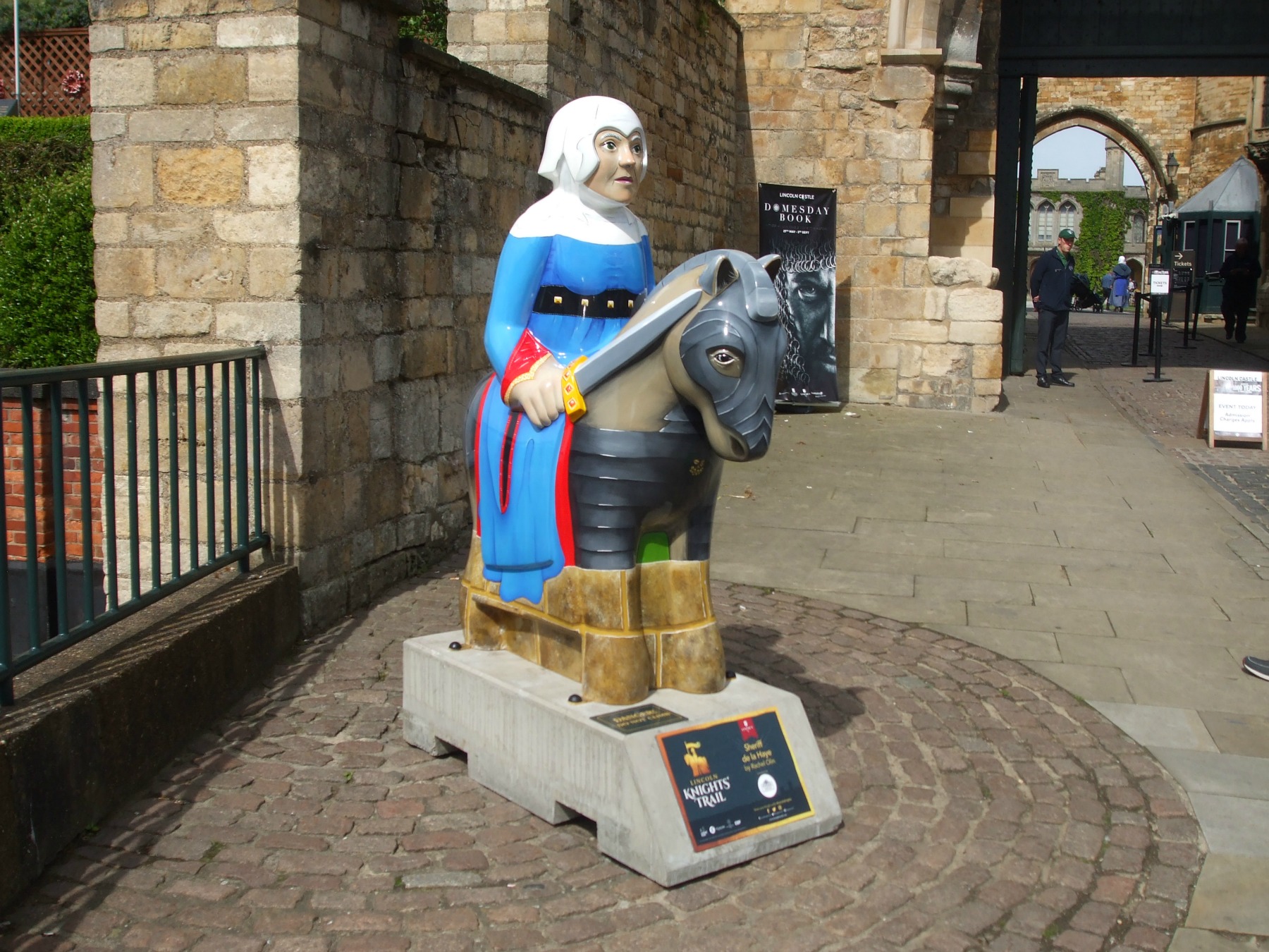
The Second Battle of Lincoln – or the Battle of Lincoln Fair– took place during the First Barons’ War on the 20th May 1217 at Lincoln Castle in Lincolnshire, England. As 2017 marks the battle’s 800th anniversary, it is being commemorated by reenactments of the battle itself together with accompanying activities for locals and visitors to enjoy. One of these extra attractions is the Knights’ Trail, which involves people finding 37 very colourfully painted models of mounted knights, all placed at prominent spots around central areas of the city.

Last Sunday (21st May) we went along to have a look at preparations for the battle and a general potter about at the castle. This Sunday (28th May) we headed off to watch the re-enactments of the different engagements involved. Needless to say the castle and surrounding areas were packed, particularly in the afternoon.

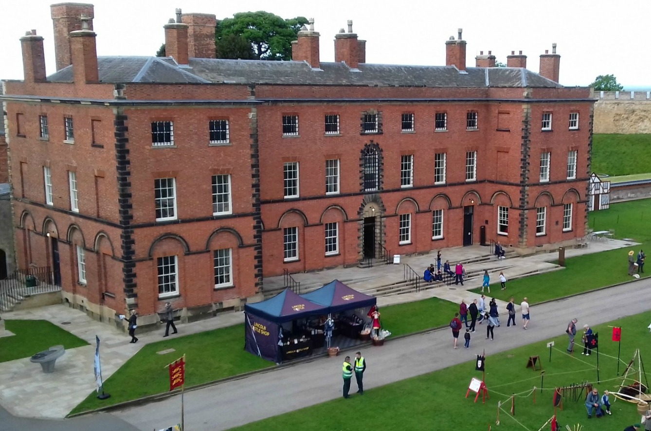
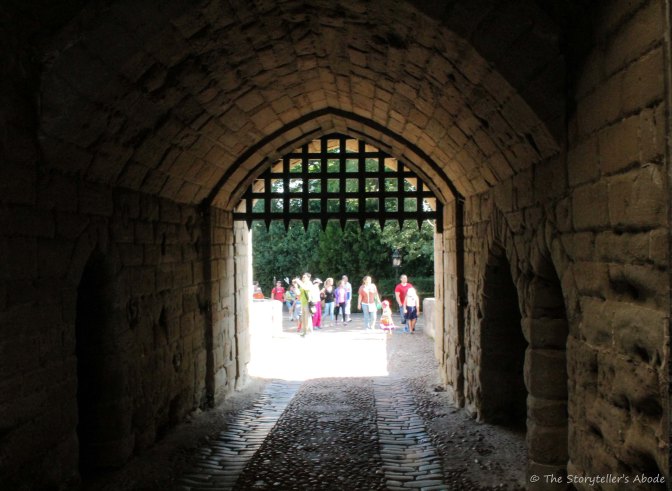
This was understandable for several reasons. Firstly, it was Bank Holiday weekend and the start of the half-term break for schools. Consequently, many families were out and about keeping children entertained as they usually are at such times. Secondly, people came to Lincoln over this particular weekend because the Domesday Book (compiled 1085-86) and Charter of the Forest (1217) were both on display along with the Magna Carta – which is resident there anyway, on loan from Lincoln Cathedral – inside the Old Prison which is in the castle bailey:

Both are incredibly important and precious documents, and although no photography was allowed, it was still wonderful to see them. The two documents will be in Lincoln throughout the summer.

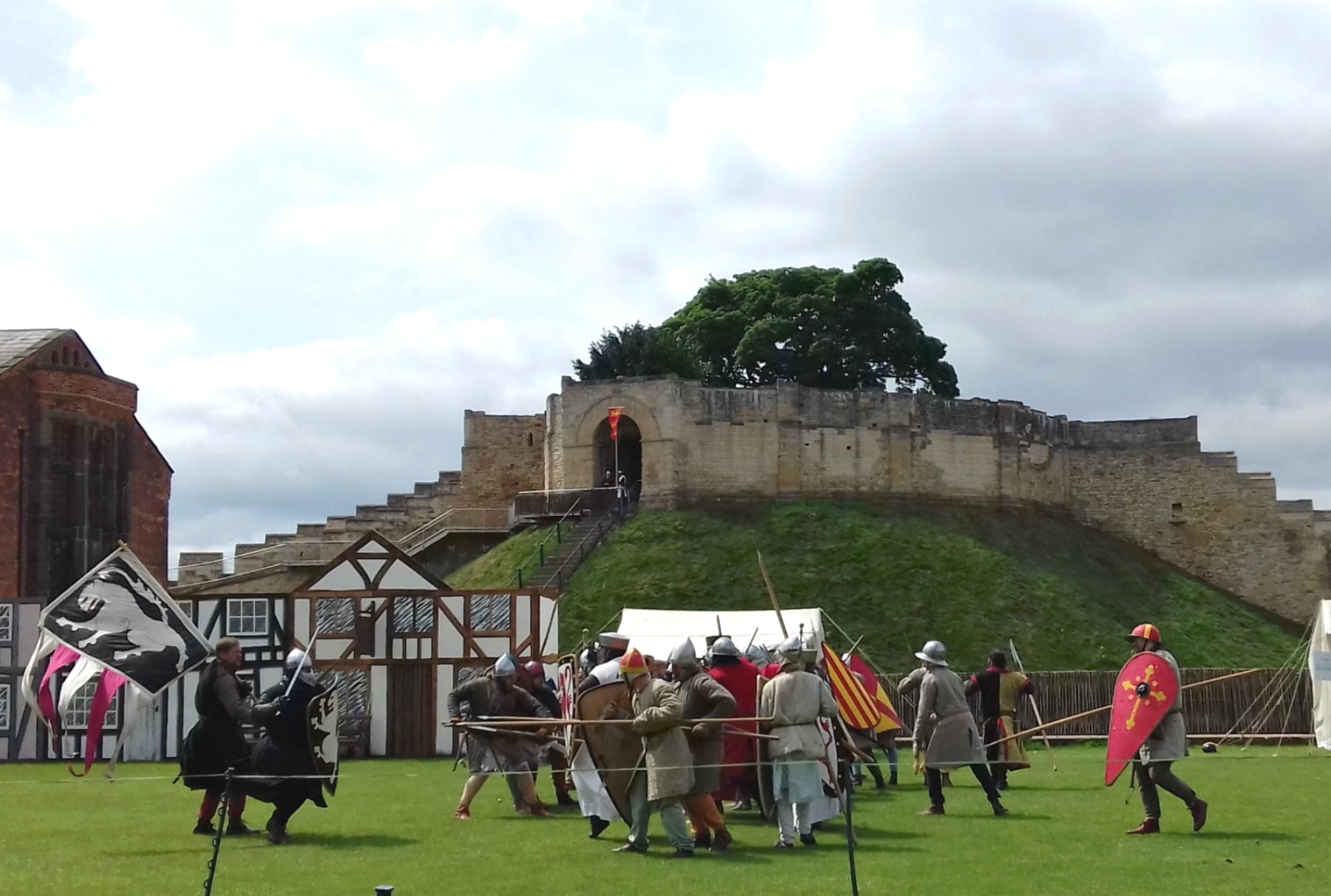
The weather was pleasant with bursts of sunshine, and everyone seemed to be having a great time. We got there around 10.30 am and had a walk round the bailey, generally ‘having a look’ at the encampment of the reenactors and various items and activities going on before the first part of the battle began. These are a few photos from around the camp. Lots of knights were about at this point, too:

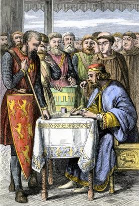
The events leading up to this battle are very much linked to King John, who had died the previous year (October 1216). John had been a very unpopular king for many reasons, most of which were based on his inability to rule wisely, as well as his questionable personality traits. When he died he left his son as king – the nine-year-old Henry – with the formidable William Marshal, the earl of Pembroke, as his regent.

Some of the barons who had rebelled against John during his reign and forced him to sign/seal the Magna Carta, had already taken steps to put the French Prince Louis (the future Louis VIII) on the English throne. On John’s death, a few of the barons returned to the loyalist side whilst others pushed on with their intentions of crowning Louis in order to stop John’s son from ruling. The kingdom was deeply divided over this.

Twenty-year-old Louis and his French armies had been in England since May 1216 and by May 1217, aided by the rebel barons, controlled half the country: only Lincoln and Dover castles had not surrendered. At the time of the battle at Lincoln Castle, the city itself was occupied by forces fighting for Louis, led by Thomas, the Comte du Perche. But the castle was steadfast. Lady Nicola de la Haye, the castellian, remained true to the royalist cause and was determined to keep this castle, with its strategic position, out of rebel hands.

Constable of Lincoln Castle, Lady Nicola de la Haye.

During the day, we watched three different events that took place at Lincoln. The first showed the arrival of the French at Lincoln and their attack on English defenders beneath the castle walls. The English are pushed back and those still alive flee up to the safety of the castle. The Comte du Perche, conspicuous with his shield displaying three chevrons, warns his men to be nice to the citizens of the city and pay for all their food and drink. It’s important to keep the people ‘on their side’!

The second reenactment showed the attack on the Lucy Tower/Lincoln Castle using two different siege engines. One of these was the perrier – one of the least complicated of medieval siege engines  It consisted of a simple frame with a huge 17 foot throwing arm with a sling. Some perriers are recorded as needing as many as 16 men to pull the ropes. It was the forerunner of the trebuchet, which has a large swinging arm to hurl missiles at the enemy and a counterweight to swing the arm. This very short clip shows the two siege engines being used on the day. The first we see is the trebuchet:

The Comte du Perche sees the bombardment as a great success, as parts of the castle walls begin to crumble.

The third engagement – the actual Battle of Lincoln Fair – followed the arrival of reinforcements for the English, led by the formidable, 70-year-old William Marshal, the earl of Pembroke and regent to the young King Henry III. This was him as he delivered his his speech about his life and duties to the Crown to the crowds earlier in the day:

Marshal had roused his loyal barons from across the country and ridden to Lincoln. The arrival of his army, together with the steadfast hold on Lincoln Castle by Lady Nicola, proved to be decisive factors in the defeat of the rebels – and the end of their attempt to put a French prince on the English throne.

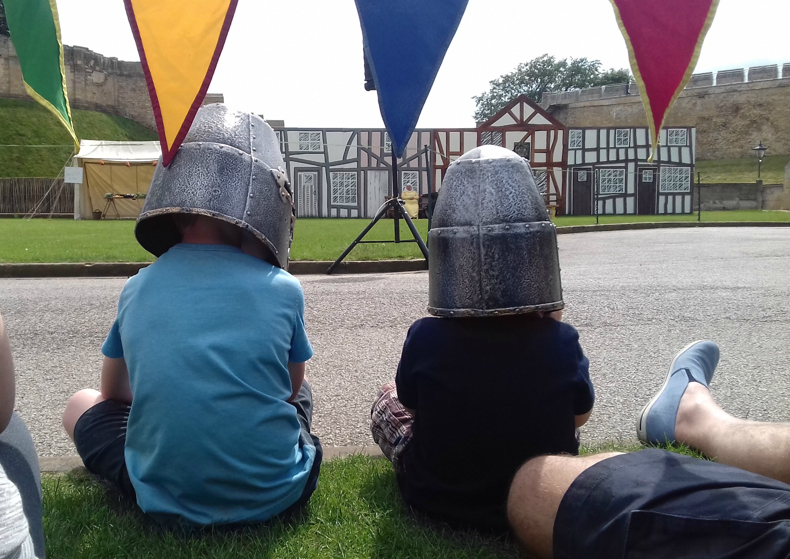
We attempted several videos of this battle but, unfortunately, there were so many spectators (and we got there too late after lunch!) to grab a good spot for photography. I managed to squat on the grass near the front – until these to two delightful little boys with buckets on their heads  – in reality, replica battle helms – decided to take the space in front of me:

I eventually managed a few photos during this battle, some of which show Lady Nicola taking stock of events from the gateway of the Lucy Tower:

Nick managed to film part of the battle, before people walked in front of him. It’s not too wonderful ‘ He missed Marshals’  rallying speech to his army, and the film  had to be cut before the end, but it gives a general idea of events. The English come in from the left on this one, and William Marshal is on horseback.

Following this short clip, English soldiers come up behind the French. Caught between two attacking armies, the rebels are soon overwhelmed. Thomas, Comte du Perche, is shown being cut down in the arena – contrary to the 13th century drawing by Matthew Paris which shows him being shot down by a crossbowman as he fled from the castle. But, whatever happened, the comte obviously died that day.

Following the battle, Marshal’s soldiers ransacked the city that had welcomed and supported the French. Most Lincoln people had hated King John and welcomed the possibility of a new king from France. Marshal’s army used that as an excuse to pillage at will as they celebrated their triumph over the combined armies of the French and rebel English barons.

And thus we have the name of The Battle of Lincoln Fair: a celebratory post-battle ‘free for all’ for William Marshal’s victorious army.

The Battle of Lincoln Fair (1): Preparations

I’ve written a few posts about visits and events connected to Lincoln Castle over the past couple of years, including the wonderful, German-style Christmas Market held annually in the castle grounds. But perhaps the most important events of recent years were in 2015, which focused on the 800 year anniversary of the signing of the Magna Carta by King John at Runneymede in 1215.

19th century coloured wood engraving of king John signing the Magna Carta. Public Domain

That Lincoln should become so involved with the Magna Carta anniversary is understandable, since one of only four of the remaining original documents from Runneymede is held at Lincoln Castle – on loan from Lincoln Cathedral. Two are held at the British Library and one at Salisbury Cathedral.

The Magna Carta anniversary involved lots of events throughout the summer in Lincoln, including the Barons’ Trail and the amazing sand sculptures displayed in the castle bailey. They all did wonders for tourism in the city and gave everything a very holiday feel.

This year, Lincoln is celebrating another anniversary, that of the Battle of Lincoln Fair (also known as the Second Battle of Lincoln) which took place in and around Lincoln Castle in 1217. This event is also linked to the infamous King John, even though he’d died the previous year.

This event is being held over two separate weekends and we went along to the first part  yesterday, Sunday May 21. This one was held in the castle bailey and presented the  preparations for battle. The second part, the actual reenactment of the battle itself, will be next weekend from Saturday to Monday, May 27-29 (Bank Holiday weekend here in the UK).

As with the Barons’ Trail of 2015, this anniversary is made fun for the city and its many visitors by having a Knights’ Trail throughout the central areas of the city. It’s a great activity for kiddies (and adults!) to hunt all 37 of the knights out. The knights are already in place, and we started photographing them yesterday. I hope to do a post about them all soon. The photo of Nicola de la Haye (or Nicholaa de la Haye, according to some sources) at the top of this post is one of them.

I don’t intend to do a full post about Lincoln Castle itself here: that’s set for a future date. But I’ll just say a little about it before I show photos of the event.

Lincoln Castle was built in 1068 on the orders of William the Conquerer. It stand on the site of the Roman fortress and settlement of Lindum Colonia (which dates from around AD60) in ‘uphill Lincoln’. This elevated position ensures the castle has commanding views of the surrounding countryside and can also be seen for miles  – as can the nearby Cathedral. It is probable that, prior to the Roman fort, a Celtic settlement once occupied the site, which I’ll discuss another time.

The castle at Lincoln was one of the finest Norman castles in the country. It consists of an outer curtain wall (with an excellent Wall Walk along the top) along which are two gates – the East and West Gates, the former having a barbican, or fortified entrance. Three towers stand along the walls, two of them built on top of mottes (mounds or small hills, often man-made for the purpose). The two towers sitting on mottes are the Lucy Tower and the Observatory Tower, the one without a motte is Cobb Hall, at the north-east corner of the wall.

Inside the curtain wall is a large bailey (courtyard) in which there are three buildings of more recent origins. The first part of the Old Prison dates from 1788 and was completed in 1848. The Court House, which is still used today, dates from 1826, and the Heritage Skills Centre is a real baby, having only been officially opened in 2013. It’s  the only new building within the castle walls for 150 years. It lies immediately behind the Law Courts:

Here are a few more photos of the castle, most taken from the Wall Walk. Some look down at the bailey, one or two at places beyond the castle, others along the wall itself:

I’ll save the detail and views inside the different towers for another time.

Tents and stalls were set up in the bailey for this event. Some of the attractions included ‘having a go’ at archery and instruction on the use and importance of  the crossbow. A  number of stalls showed foods and weapons of the time and there were birds of prey trained for hunting on display. We missed the actual presentation of the different birds of prey as we were up on top of the wall at the time. Still, we heard the falconer announce that he couldn’t allow the birds to fly at present because of the peregrines nesting on the cathedral – who would see his birds as competition and we could end up witnessing an airborne battle!

Here are a few photos of attractions and displays from around the Bailey, from ground level:

And here are a few of two of the demonstrations we watched. The fist was of knights (comically) preparing for battle.

The second was of three mounted knights displaying their skills in attacking their opponents – one of the ‘opponents’ being a cabbage, which represented the head of a Norman knight. 😀 The smaller of the three horses was included to demonstrate the type of horse/pony used prior to Norman times. It’s the type that was used by the Vikings and is the only breed to be found in Iceland today.

Finally, here are a few photos of Nicola de la Haye (the constable of the castle) and an episode with a French envoy who had come to persuade her to surrender the castle to the French invaders who intended to put their own Prince Louis on the English throne. In doing that, they would simply depose the son of King John – the nine-year-old Henry III. The French were supported in this by the barons who had rebelled against King John. Nicola adamantly refuses and, as the French have already landed in England, she prepares the castle garrison for forthcoming battle:

And absolutely lastly, the Battle of Lincoln Fair was named from the festivities that followed in Lincoln after the French were defeated in the battle. This drawing, by Matthew Paris in the 13th century, shows the death of the French commander as the French flee from the castle. It also shows the importance of the crossbow.

Image from Wikimedia Commons. Public Domain


A Look at Cornwall (5): The Lost Gardens of Heligan

We visited the Lost Gardens of Heligan in the afternoon of the second day of our holiday in Cornwall in June 2016. After spending a full Monday morning and early afternoon at Tintagel (the subject of A Look at Cornwall (4)) we decided to stop off on our way back to Newlyn for a quick look round this fabulous site. It was a gloriously sunny afternoon and we could have done with many more hours there.

This map shows where Heligan is located in Cornwall. (X marks the spot). The site is a mile and a half from Mevagissey and six miles from St. Austell. It’s also only ten miles from another famous Cornish attraction, The Eden Project – which we haven’t visited since 2003.

X marks the approximate location of the Lost Gardens of Heligan, near Mevagissey, Cornwall UK

There are many wonderful gardens in Cornwall, all of them well worth a visit, but as the name suggests, the Lost Gardens of Heligan are particularly special. Not only are they amongst Cornwall’s finest gardens but – as you might guess – the word ‘Lost’ is the reason why they’re special. The story of how they were ‘found’ again – in other words, restored – is interesting as well as being an incredible feat.

At Heligan today there are over 200 acres of Victorian walled gardens, working buildings including bothies, a potting shed and a tool shed. There are exotic glasshouses, pleasure gardens, lawns, lakes and ponds and many acres of orchard as well as a farm (Home Farm, where lovely old breeds of cattle, sheep and pigs are reared) 22 acres of subtropical jungle and a 30 acre ‘Lost Valley’. But for many years following WWI, the beautiful gardens lay neglected and overgrown, the glasshouses broken and useless. So what is the story behind all this?

Heligan House was built by William Tremayne in 1603. It was the home of the Tremayne family who controlled over 1000 acres in the area. It is still privately owned and not open to the public.

Heligan House. The house is in private occupation and not open to the public. Source: geograph.org.uk Author: Neil Clifton. Creative Commons

Before WWI, the estate was completely self-sufficient, having its own quarries, woods, farms, a brickworks – the earliest in Cornwall – a flour mill, sawmill, brewery and productive orchards and gardens. Apart from luxury goods, the only imports were lime for fertilisers and coal for heating.

Most of the gardens and ornamental woodlands were created during the 19th century by the successive efforts of Henry Hawkins Tremayne, John Tremayne and John Claude Tremayne, all noted botanists and horticulturalists.

Henry Hawkins Tremayne (1766-1829) in black coat and waistcoat with aubergine lining, white coat, powdered hair. Source: Christies. Author: Henry Bone (1755-1834) Public Domain

By 1900 they had amassed a wonderful collection of trees and shrubs from all over the world. Follies and temples were scattered throughout and walks and rides were created. The local community depended on the estate for income: it was the centre of the community, with 20 house staff and 22 garden staff.

But the First World War changed all this, just as it did with most stately homes at that time (as shown in the fictional Downton Abbey).

In 1914, the male staff at Heligan ‘signed up’ for active service, most being sent out to the trenches on the Western Front. Heligan House was taken over by the War Office and became a convalescent home for officers. The house was returned to the family in 1919, but after the war, only 6 of the 22 garden staff returned, the rest having not survived the battles in Flanders.

The following picture is from an information board at Heligan…

…accompanied by these notes:

We know the names of 13 outdoor staff who served in World War One and have sown a field of Flanders Poppies in thankful memory of all of them, including 4 who served and returned. (Individual photos were given by relatives of those brave Heligan men.)

During the Second World War, the house was allocated to the US army (practice landings for D-Day took place a mile away at Pentewan Beach). The gardens remained with the Tremaynes, but for many years after the war the gardens were simply neglected, remaining in a time capsule – efectively, ‘lost’. But, in 1990, a chance meeting between John Willis, a Tremayne family member, Tim Smit (an archaeologist) and John Nelson saw the start of an amazing journey of restoration. When Smit and Nelson discovered a tiny cubicle at the bottom of a small, walled garden (since known as the Thunderbox Room – yes, the toilet) and saw the pencil signatures written on the flaking plaster walls, evoking past lives, they knew that the restoration project must be undertaken in the names of those former Heligan workers.

The Thunderbox room at Heligan (far doorway, through which the child has just emerged).
Fading, pe-WWI pencil signatures on the flaking lime walls of the ‘Thunderbox’ at Heligan. Photo from the same information board as the one of the servicemen above.

Before I share some photos of the parts of Heligan we managed to see in the short time we had, here are a few images (from information boards again) of what the site looked like in 1990, i.e. before restoration started:

And this photo shows what the head gardener’s hut looks like now, after careful restoration:

And these are the bee skeps now, on Bee Bole Lawn, which we passed on our walkabout:

In the following photos, I have tried to show things we saw along the way as we walked round. We had no particular, pre-arranged  route, and just went where the fancy took us.

This is the Entrance:

From the ticket office, we set off along the paths towards Flora’s Garden:

Next we spent some time investigating the different walled gardens and outhouses:

From the walled gardens we headed along the Woodland Walk, where we found some great woodland sculptures, all created by local artists.

This is my final set of photos before this post becomes ridiculously long. They are of an area of Heligan known as the Jungle. It covers an area of eight acres with what is described as ‘a watercourse’ running along the floor of the valley that links four ponds. The ‘big house’ looks down the valley, which winds its way to Mevagissey. It houses a collection of sub tropical plants and was created a hundred and fifty years ago when a craze for collecting exotic plants swept the country. Cornwall’s mild climate is ideal for such species. Visitors follow boardwalks along the valley.

Eventually we headed back to the entrance, with Louise being disappointed at not having found the one place at Heligan we all remembered from 2003. It was simply some stone steps that Louise had taken a photo of. Some years later, she created a very lovely painting (acrylic on canvas) of the image – a huge one that stands on an easel. As we got closer to the cafe and shop we saw an interesting-looking opening between some rocks and decided to investigate. And there we found the steps – which we all duly photographed again.


Although we managed to see a lot of the gardens, there were areas of the site we didn’t have time to get to – including the Lost Valley and Home Farm – so they’re now at the top of the list for our next trip down to Cornwall. And next time, we’ll get there in plenty of time to enjoy a Cornish cream tea in the cafe. On this occasion, it had already closed. 😦

A Look at Cornwall (4): The Magic of Tintagel

island-courtyard-6

On the second full day of our week in Cornwall last year – a Monday – we set off from Newlyn in the south-west of the county where we were staying, and headed north-east for 63 miles to the site of the village of Tintagel and its famous castle.

Tintagel Castle is one of the most famous historic sites in Britain and long associated with King Arthur, though its history reaches back centuries before the tales of the legendary king. The actual name, ‘Tintagel’, probably comes from the Cornish word ‘Dindagell’ or ‘Dintagel’, meaning ‘fort on the constriction’, or ‘fort on the headland’.

Tintagel sits on one of the finest sections of the Cornish Coastal Path and is built half on the mainland and half on a jagged headland or ‘island’ that projects out into the Cornish Sea. These photos, as the one directly above from an information board at the site, show the connecting bridge between the mainland and island.

We started our visit in the village of Tintagel – where most tourists park – before heading up the track for the half-mile walk towards Tintagel Head and the castle. The car park we chose was opposite a very aptly named pub, where we stopped off for coffee before setting off:

And this is the track…

This is the signpost at the bottom of the first part of the climb up to the castle. If we carry on walking past here, we come to the Beach Cafe and visitor facilities – and the sea.

Before I show a few photos of the parts of the castle we explored, here’s a little about the history of the Tintagel area.

The site of the castle has been inhabited since the Roman period and probably even earlier. There is no real evidence of an Iron Age fort, although it is believed that the site would have been similar to promontory forts on other S.W. headlands – such as at the Willapark headland a mile to the east. Nor is it known how much activity there was at the site in the Roman period. There is no evidence of Roman structures, but a few artefacts dating from the late 3rd to the early 4th century have been found, including an inscribed pillar. This was originally in the cemetery of St Materiana’s, the 11th century church in Tintagel village, but has since been taken inside the church itself. Other small finds, such as Roman coins and pottery have also been discovered in the area.

During the so-called ‘Dark Ages’ – roughly the 5th-7th centuries – Tintagel was an important and prosperous stronghold. Right across the island are the remains of rectangular houses. Fragments of glassware, wine-jars and other decorated pottery vessels have also been found, all evidence of a thriving trade with Mediterranean regions at this time. Some of these Dark Age houses can be seen in the next few photos:

There is little evidence of activity over the following 500 years. Then, in 1138, Geoffrey of Monmouth in his work, History of the Kings of Britain, linked Tintagel to King Arthur. Since the site had no military value, it seems it was this legend that inspired Richard, Earl of Cornwall, the younger brother of King Henry 111, to build Tintagel Castle here in 1230.

In the early centuries an isthmus (narrow neck of land) would have linked the mainland to the island. We know that the isthmus survived until the 12th century, as it was recorded by Geoffrey of Monmouth in the above-named book. But by the time Earl Richard was building his castle the isthmus had already partly eroded away and by 1540, the antiquary John Leland reported that the only way onto the island was by longe elme trees layde for a bryge. Today, passage between mainland and island is via the man-made, wooden bridge shown above.

And so our journey upward began…

Once we got to the top of the incline leading from the signpost on the lane, we arrived at the first part of the castle, which is on the mainland. The ticket kiosk is here and as we’re members of English Heritage we didn’t have to pay – other than the cost of the requisite Guide Book (requisite for me, that is). We didn’t stop to explore the mainland section of the castle as we were keen to get over to the island. So on we pushed towards the island, across the bridge and up dozens of steps, with my rickety knees complaining all the way.  

But the views of the sea, the beach and cliffs – not to mention, Merlin’s Cave – were worth it:

The parts of Earl Richard’s castle on the mainland include the lower and upper courtyards, or outer bailey, which has suffered greatly from erosion of the cliffs. When the castle was built in 1230, the mainland and island parts of the castle were connected by what was left of the isthmus, which had already partly eroded. Richard probably fortified this neck of land with a gatehouse and possibly some kind of drawbridge, which has now been lost as a result of landslips.

Our first stop on the island was the inner ward, or courtyard, with a great hall and chambers. Between 1240 and 1260, a curtain wall was built, forming a high, battlemented enclosure around the courtyard:

We pushed on through the gate in the curtain wall…

…and headed on up toward the top of the island:

The ruins at the top of the island date mostly from the Middle Ages. There is a well…

…and a small walled garden. The garden was first recorded in the 1540s  and excavations  in the 1930s show it was used for flower beds and herbs, although its position on the top of the island seems strange.  The garden has since become linked with the story of Tristan and Yreult/Isolde. In some versions of the myth, the lovers meet in the garden. A number of slates inside the wall, tell part of the story. Unfortunately, the light on some of them make them difficult to read:

Further on, close to the edge of the cliffs, we came to the statue of the warrior (King Arthur?):

And to finish off, here are a few photos of the views from up there:

***

References:

Guide Book and leaflets from Tintagel Castle

Wikipedia

English Heritage: http://www.english-heritage.org.uk/visit/places/tintagel-castle/

A Look at Cornwall (3): As I was going to St Ives…

st-ives-beach-3

 As I was going to St. Ives,
I met a man with seven wives,
Each wife had seven sacks,
Each sack had seven cats,
Each cat had seven kits,
Kits, cats, sacks, and wives.
How many were going to St. Ives?

Perhaps the main thing most people know about this Cornish seaside town is the old poem/nursery rhyme/riddle As I was going to St Ives. This anonymous poem was originally printed around 1730 – but in that version there were nine wives. The modern version, with seven wives, appeared in 1825. Although there are a number of St Ives in England and elsewhere, the poem is generally thought to refer to the one in Cornwall.

The answer to the question in the last line is usually assumed to be that only one person is heading towards St Ives while the others – wives, cats or kits – are heading away from the town. But the poem gives us no indication of the direction in which the others are heading. It has been suggested that the person going to St Ives could even have overtaken the party as they were also heading to St Ives!

This little video was uploaded to YouTube by Appuseries. I have to admit, I’ve never heard the poem sung before but it’s very sweet.

We visited St Ives in June 2016 on the first whole day of our stay in Cornwall. It was the third site we visited that day, and we didn’t spend too long there, but we managed to take a few photos. For this post I’ve used several images from Wikipedia to illustrate places we didn’t get to see.

To start with here’s a location map…

cornwall-map-to-show-st-ives-and-penzance

St Ives is one of Cornwall’s most famous destinations. It is situated to the north of Penzance on St Ives Bay at the edge of the Celtic Sea. The name of St Ives is attributed to the Irish Saint Ia the Virgin in the 5th century, and the old town is clustered around the parish church of St Ia, built in the 15th century. The church can be seen clearly in this nighttime photo:

stives_spring_night
St Ives, spring night. Author: Dave Taskis, 11th April 2007. Creative Commons

Since medieval times fishing has been of great importance to St Ives and the town became one of most important fishing ports on the north coast of Cornwall. The Sloop Inn on the Wharf dates from 1312 and is one of the oldest in Cornwall. It was a fisherman’s pub for many centuries, a reminder of the town’s importance – and former dependence – on fishing:

St Ives. The Sloop Inn, serving traditional food, is located here. From geograph.org.uk Author: Kenneth Allen Creative Commons

Commercial fishing is very reduced today but the harbour is still in use, often for recreational boating and tourist fishing, and since 1930, people have been taking boat trips out to Seal Island, 3.5 miles/6km to the west of St. Ives. The island is home to over 40 seals.

The Carracks, a group of offshore rocky islands, known locally as Seal Island. The boat is probably one of the regular tourist trips from St. Ives. From geograph.org.uk. Author: Tony Atkin Creative Commons

Today, St Ives has become primarily a seaside resort, renowned for its working harbour surrounded by beautiful beaches. The irregular coastline ensures sunlight on the different beaches throughout the day. There are four main beaches, two on either side of ‘The Island’ which is also known as Pendinas. It is not an island at all but a promontory. On the photo below, taken from above Porthmeor Beach, the small Chapel of St Nicholas can be seen sitting on top of Pendinas. The one-roomed granite building was an ancient fort and has become a birdwatchers’ paradise. Of the four beaches, we  managed to visit two of them, one on either side of Pendinas: Porthmeor Beach and the Harbour Beach.

the-island-st-ives-showing-st-nicholas-chapel

The town boasts art galleries, cafes, restaurants pubs and shops and is known for its quaint streets and alleys. There are also many old fishermen’s cottages we didn’t have time to see, as well and one of the four Tate Galleries in the world.  After we’d spent time at Carn Euny and Land’s End, our visit to St Ives was pitifully short, but it was enough for us to get the general feel of the place.

These few images from Wikipedia give more of an overview of St Ives than we were able to get:

We headed into St Ives along the northern coast and parked on a road up on the hillside looking down on Porthmeor Beach. These photos were taken as we walked towards the town centre. To the right in the first photo is the lifeguard station:

We then turned into the town centre and took a few photos of the streets and shops:

Then we headed across to the lovely harbour where lots of people were enjoying the June sunshine and the ever-present seagulls.

*

On our second day in Cornwall we visited two more of the county’s most famous sites: Tintagel and the Gardens of Heligan. So my next post will be about Tintagel.

*****

A Look at Cornwall (2): Land’s End

cornish-lands-end

Land’s End – or Penn an Wlas in Cornish – was the second site we visited in the far south-west of Cornwall on the first full day of our holiday. It’s located 8 miles west of Penzance at the end of the A30, a road notorious for its traffic jams throughout the summer due to the thousands of tourists, and is in the village and parish of Sennen.

location-of-lands-end-in-the-penwith-peninsulaPeal Point/Land’s End is the most westerly point in Britain, and the area boasts some of the country’s most beautiful natural coastline. Stunning 200 feet high cliffs are still carved out by huge Atlantic waves and views are magnificent in both directions along the coast as well as out to sea. Seabirds circle above and the area has become legendary as a place for bird watching. Gannets, fulmars, kittiwakes, shags, razorbills and even Cornish choughs (pronounced ‘chuffs’) once extinct in Cornwall, are making a welcome come-back.

These are a couple of worse-for-wear information boards about the bird and sea life of the area.

Land’s End and John o’ Groats in the far north-east of Scotland, have become renowned as the two extremities of Britain, as this map from Wikipedia shows:

map-showong-lands-end-to-john-o-groats

These are the signposts at Land’s End and John o’Groats. Both images are from Wikipedia. We couldn’t get near the one at Land’s End to get a decent photo because of the queues of people waiting for the professional photographer to snap them all, smiling nicely beside the famous signpost (at £10 a time).

The route of 874 miles has often been travelled by walkers and/or cyclists, either as individuals or in small groups and for a variety of reasons. For some it has been a matter of personal achievement, whereas others, often well known personalities, have undertaken the route as a means of raising money for charity – as cricketer, Ian Botham, did in 1985, and the terminally ill cancer sufferer, Jane Tomlinson did in 2003. The first recorded walk of the route was in 1871 by the brothers John and Robert Naylor.

I must admit, on arrival at the Centre we were quite surprised. Having never been to Land’s End before we expected to see just views of the renowned landmark. What we found was a collection of buildings including several ‘eateries’, shops and a list of interactive entertainments that take place throughout the spring and summer months – including a fireworks display, Pirates Day and so on. Naturally, these are aimed at families with children which, I suppose, sounds sensible. Most children would soon get bored just walking around with parents simply taking photographs. But a few reviews on the online sites I checked include criticisms of the place having become ‘more like a theme park’ than a beauty spot. It’s free to enter the Visitor Centre, but there are extra costs for the ‘extras’.

These photos are of the outside, apart from the cafe. We didn’t bother looking round the souvenir shops:

The Visitor Centre itself doesn’t sit on the site of the actual point of Land’s End. That’s a little further along, northwards, and is also known as Peal Point. It can be seen in the first photo below:

Just over a mile offshore and visible from the headland is a group of islets called the Longships. How dangerous these were to shipping in the past is evident in the need for a lighthouse. Together with the Seven Stones Reef and the Isles of Scilly, 28 miles to the south-east, these islets form part of the mythical lost land of Lyonesse in the Arthurian legends.

Since Norman times (1066 0nwards) a number of custodians have looked after Land’s End, and it is currently owned by a private company called Heritage Attractions/Heritagegb. This legendary Cornish destination has inspired people since Greek times, when (according to an information leaflet from the site) it was known as Belerion – the shining land.  The whole area is steeped in history and people have travelled to, and been living here, for at least 10 thousand years. The granitic lands away from the coast are home to a Neolithic (Stone Age) cemetery. Bronze Age burial mounds and an Iron Age hill fort can be found within 200 yards of Land’s End.

looking-inland-at-lands-end

In the early 19th century, it was to The First and Last Inn, just a mile away from Land’s End that travellers in their coaches would stop for food and rest before continuing on to the famous landmark on foot or horseback. We passed it, just before reaching the Centre, but didn’t think to take any photos. It could well be the distant white building on the photo above, though I can’t be sure. But the inn is somewhere over in that direction – and is still open today. The Inn is one of the most famous in Cornwall and not only because of its location. It has had a notorious reputation since the 1600s of being the headquarters of smugglers and wreckers.

Nowadays visitors to Land’s End are more likely to walk to the building shown on my featured image and the photo below for refreshment. If they continue along the coastal path, past the actual point of Land’s End, they will come to a building called ‘The First And Last House‘.

most-westerly-point-in-englandThis was originally opened by Gracie Thomas who served travellers to Land’s End with food and drink, as well as a piece of local granite as a souvenir. Today, gifts, toys and refreshments are still offered here, as well as Cornish ice cream.

By the time we left Land’s End, having previously spent a long time at Carn Euny, it was well past lunchtime. So we headed northward towards St Just to have something to eat before we all starved to death. Then we continued on to seaside town of St Ives – which I’ll post about next.

*****************

A Look at Cornwall (1): Carn Euny Village

carn-euny-iron-age-village-plan

In June last year (2016) Nick and I, accompanied by our blogging daughter Louise (afairymind) at thestorytellersabode, headed down to Cornwall for a week.

Cornwall is very beautiful, with stunning scenery both along the coast and inland (as fellow blogger draliman, who lives there will affirm. I’ve linked to a post here in which Ali shares a few photos of his beloved Cornwall. We had the great pleasure of meeting up with him during the week). Culturally, Cornwall is closer to our Celtic neighbours in Wales than to other English counties, as the many place-names suggest. I wrote a brief, introductory post about Cornwall while we were still down there last June but, as often happens with me, I didn’t get round to doing the rest once we got home. We visited many great sites and I intend to write up several over the next few weeks.

We rented a cottage for the week in the little fishing village of Newlyn on the south coast of the Penwith peninsula in the far south-west of Cornwall. Newlyn is only a few minutes drive from the bigger fishing town of Penzance (yes, Cornwall is renowned for its fishing industry and Penzance for that wonderful opera!). The photo below is of Newlyn harbour.

newlyn-1

The first site we visited the day after our arrival wasn’t a long drive from Newlyn, as it was also located in the Penwith peninsula. The site was Carn Euny (approximate location marked with the red x on the map of Cornwall below).

approximate-location-of-carn-euny-in-sw-cornwall

Carn Euny is an Iron-Age-Romano-British village, established in 400 BC and occupied until the 4th century AD. Formerly known as Chapel Euny, this ancient village is located in the Penwith peninsula, in granite uplands rich in antiquities.

To reach the village from the car park we followed Route 1, one of the two possible lanes. It was dry and sunny the week we were there so we had a lovely walk, but it can be very muddy underfoot after rain. Here’s a plan from the site – a terrible photo, which I hadn’t intended to use, but it shows the two paths (just!):

two-paths-to-carn-euny-village

These are a mixture of views along Route 1 on our walk to the village and back. The abandoned van was an interesting and intriguing surprise:

Arriving at Carn Euny village, we had a look at a couple of information boards and site plans. This one mentions another ancient site which we also visited during that week (Chysauster).

general-info-about-carn-euny-village-2

The following is a plan of the different houses at Carn Euny, as well as the fogou and ruins of a cottage dated approximately 1750.

plan-of-carn-euny

The site includes the foundations of stone houses from the 2nd-4th centuries AD, with evidence of timber and turf houses from much earlier settlement, as well as a fogou (which I’ll describe a little further on). The following photos give an ‘overview’ of the stone houses of the site, the foundations of which have walls up to a metre high in places:

In the middle of these stone houses is a fascinating Iron-Age structure known as a fogou – a feature found only in the far west of Cornwall. The name comes from a late Cornish word meaning cave – an underground, or partly underground, structure. The fogou at Carn Euny is, according to the guide book, “unique  in having a round chamber as well as the long passage characteristic of most fogous”.

These are a few of the photos we took of the fogou:

Fogous basically consist of a main passage, often aligned east-west or north-east to south-west. The passage is built of dry stone walls, which can be seen in the photos, and roofed with giant capstones – in evidence at the entrances and sketched into the diagram above. Subsidiary chambers and small narrow side passages are also features. Theories for the purpose of fogous range from hideouts in time of trouble to cellars for storing goods and livestock. At Carn Euny, there is evidence that the fogou could have been for religious purposes – “the parish church of ancient times” (according to the guide book again). There is also evidence that the round chamber here could have been a cult centre before the long passage was built. As for dating, most fogous seem to have been built in the later Iron Age (i.e. 400 BC – AD 43).

Nothing seems to have been known about the fogou or settlement at Carn Euny before the first half of the 19th century when it was discovered by miners excavating for tin. Cornish antiquary, William Copeland Borlase excavated the fogou between 1863 and 68, but it wasn’t until the 1920s that any of the houses were examined.

The Carn Euny Fogou from an 1869 drawing by J.T.Blight and W.C Borlase. Public Domain

As with many ancient sites, including Hadrian’s Wall and the monasteries and abbeys ordered to be pulled down in the dissolution of the monasteries of 1536-39, Carn Euny suffered extensive damage over the years from stone robbing for local buildings, field walls, stock shelters, gate posts and so on. The cultivation of fields for potatoes and daffodils – for which Cornwall is famous – caused further damage to the site, as did miners prospecting for tin. All in all the original form of the houses isn’t at all clear. Nevertheless, ten houses from the Romano-British period have been excavated (house numbers on the plan relate to the order of excavation).

Houses seem to be interlocking, courtyard-style structures, arranged haphazardly across the site (unlike at Chysauster, a later village, where houses are along a central street). Courtyard-style houses are usually oval, enclosed by a thick outer wall with a paved entrance facing away from the prevailing SW winds. The entrance leads into the courtyard, around which several rooms are built into the thickness of the outer wall. A large oval or circular room opposite the entrance is thought to have been the main living room, with the other rooms serving as stables and storage areas. Thatch roofing is thought to have covered the rooms, leaving the courtyard open to the elements. Stone capped drains for bringing water in and out of the houses are also a feature.

This is  an impression of what the village may have looked like in the 4th century AD from a notice board at the site. Unfortunately it’s very faint, so not very clear.

carn-euny-in-the-romano-british-period

Lastly, here are a few photos of the remains of the cottage (the presence of which which with its accompanying cultivation of fields etc. would have also contributed to damage at the site.)

Carn Euny is a wonderful site to visit, especially on a sunny day. There are no facilities or information centre there, so it was a quiet experiences for us on a school day in June. There are plenty of information boards for visitors to understand the layout of the village and make their own way round. We bought a guide book later in the week when we went to Chysauster, where there’s a small information centre. I suppose the best idea would be to go to Chysauster first… But we didn’t know that at the time.

******

A Fun Day at Warwick Castle – Part 3

This is my third and last post about Warwick Castle in Warwickshire UK, which we visited in August 2015. This time I’d like to show some photos of the event we actually went to Warwick to see: the joust.

joust-1

The joust is one of the seasonal attractions at Warwick Castle, the others being demonstrations of the trebuchet (pronounced treb-you-shay) in action, birds of prey shows and many others. Events do change from year to year, and not all are held in the summer holidays. During other school holidays, like half-term and Easter, several events are put on, especially ones for children (or ‘little warriors’). This year (2017) in both May and September, there will be ‘The Wars of the Roses Live’, which I’d like to try to get to! There’s also a Kingmakers Medieval Banquet in February. Here’s a link to the officials Castle Events Guide for this year.

All  spectators were seated on the grass at the opposite side of the river, which is a fair way back from the action, and as none of us apart from Louise had a decent zoom on our cameras, I’m afraid the photos aren’t too wonderful. Nor did it help that people kept bobbing up in front of us, but as most of them were children, they’re forgiven. It was a fun event, made even better by the lovely sunny weather (which has to have an obligatory mention for any outdoor event in Britain!) – not to mention the handsome and chivalrous knights, who kindly made themselves available for interacting with spectators afterwards.

Here are a few more photos:

Around the castle site a number of medieval siege weapons can be seen, the main ones being the trebuchet and the mangonel. The Warwick trebuchet is the biggest in the world Both of these siege engines were used for hurling a variety of projectiles/objects over castle walls as part of the attack – including rocks, burning missiles (fireballs), disease-infected carcasses of slaughtered animals,  and even the heads of slain enemies. Here are a couple of photos of each:

These weapons deserve more time than I can give them here to describe and talk about. But on some days, the main event at Warwick is a demonstration of how the trebuchet works, so to finish with, here’s a 2 minute video from YouTube of one demonstration. It was uploaded by Bob Astill in 2011:

That’s all about Warwick Castle for now.

A Fun Day at Warwick Castle – Part 2

courtyard-from-the-motte-and-bailey
View of the courtyard from the motte-and-bailey

In Part 1 of this post, I wrote about the construction and design of the various buildings that have become the Warwick Castle we see today. In this post I’d like to show some of the fun activities laid on at the time of our visit in August 2015 and a few of the displays and waxworks inside parts of the castle.

First, here’s the plan of the castle again for easy reference if need be:

warwick-castle-plan

The first thing we noticed on the gloriously sunny day we drove out to Warwick was the number of stalls and activities set up both in the outer ward (outside the curtain wall) and around the courtyard:

Warwick Castle was bought by The Madame Tussauds Group in 1978 and opened as a major tourist attraction. Throughout the summer holidays, fun events and activities are staged at the Castle, all aimed at attracting and entertaining families and hopefully, helping children to develop an interest in history. Entry isn’t free, nor is the castle owned/managed by either the National Trust or English Heritage, and families with several children would find it an expensive day out. In addition, there’s an extra fee for anyone wanting to enter the dungeon in Caesar’s Tower. A little about the dungeon later…

Most of the permanent displays are set out in the Great Hall, State Rooms and family apartments inside the collection of buildings along the eastern side of the castle, flanked by the River Avon. The waxwork figures are impressive, to say the least. These two photos show the inner/courtyard side of the buildings  along the east side of the castle and a close-up of the entrance, which takes us into the State Rooms and many displays:


The first place we come to is the Great Hall. This was originally built in the 13th century, then rebuilt in the 17th century for visiting guests of the Earl of Warwick. It was further restored in 1871 following a great fire which left it in ruin. The displays in here are all connected with weapons and armour:

Next we headed to the rooms in the undercroft devoted to ‘The Kingmaker’, Richard Neville (1428-71). Neville was  the 16th Earl of Warwick, who took command of the castle in 1449. He was a good administrator who did much to modernise and improve the castle, and in the second half of the 15th century he became the most powerful man in Britain. The exhibits describe his life and subsequent death at the Battle of Barnet. They also show his life at the castle, as well as the lives of others who lived there. Here’s a selection of the many photos we took – some of which were ruined by glary lights.

I won’t include photos of the various State Rooms here (i.e. rooms such as the formal dining room) just a few photos taken in the adjacent family rooms, which displayed events and characters from A Royal Weekend Party. This was a party given/organised by Frances (fondly known as ‘Daisy’) Countess of Warwick in 1898. The principal guest was the then Prince of Wales, later Edward V111. It is believed that the Prince of Wales’ infatuation with Daisy was the inspiration for the song that starts:

Daisy, Daisy. give me your answer do

The song was written by English songwriter Harry Dacre (pen-name of Frank Dean) in 1892;

And this is a cute little YouTube video of the famous song, from kidsmusicshop1:

To finish this post, here’s a little bit about the gaol and dungeon inside Caesar’s Tower:

The rooms inside Caesar’s Tower are interesting to visit, although it was only permitted as part of a guided tour – and cost an extra £9.00 to get in. We were led round various rooms to watch a series of short dramatizations – some of which were a bit gory (all pretend!). One was in a torture chamber and another was a medical ‘operation’! Yet another was a medieval court scene whereby a judge pronounced ridiculously unjust punishments on prisoners who had supposedly committed some small crime – like stealing a cabbage. Needless to say, members of the audience were picked to play these unfortunate prisoners (my husband being one of them!). It was just a shame that photography wasn’t allowed.

Eventually we headed underground to the dungeon. This was similar to most dungeons I’ve seen elsewhere, with very little light and graffiti on the walls from prisoners of centuries ago. And awful torture chambers.

This image is from Wikipedia:

675px-warwick_castle_torture
A gibbet on display in the basement of Caesar’s Tower at Warwick Castle. Author: Chensiyuan. Creative Commons

Apologies for the glary patch on this information board!

prisoners-and-the-dungeon

But the most interesting thing in this dungeon was this:

oubliette-at-warwick

This grille on the dungeon floor is the opening into what is called an oubliette – a very chilling thing indeed. Any unfortunate prisoner put into to this tiny space – not even big enough for him to stand up in – was effectively forgotten and left there to die.

info-about-oubliette

In the third post about Warwick Castle, I’ll eventually get round to writing about the event we actually went to Warwick to see: the joust.

*****

A Fun Day Out at Warwick Castle – Part 1

warwick-castle-the-east-front-by-canaletto-in-1752
East Front from the Outer Court, 1752. Painted by Canaletto (1697-1768). Birmingham Museum and Art Gallery. Originally uploaded by Gillian Tipson at English Wikipedia. Public Domain.

I last visited Warwick Castle on a family day out in August, 2015, and have been meaning to write a post about it since then. Well, here’s the first part (it would be far too long as a single post and is likely to end up being three!). Louise – aka @afairymind – shared some of her photos from the day on her blog, ages ago. I’m just late with mine, as usual.

Warwick (pronounced Warrick) is one of the most famous and well-visited castles in England. It is also one of the most complete medieval fortresses in Britain. I’ve visited the castle several times, some of those with classes of Year 7 students aiming to decide how they’d attack and defend this great structure – and the weapons they’d choose to do it. But, I digress… so back to describing the place.

Warwick Castle is situated on a sandstone cliff along a bend in the River Avon in the town of Warwick, in Warwickshire:location-of-warwick-castle

The history of the castle site goes back to the time of King Alfred’s daughter, Aethellflaed /Ethelfleda who established a fortified burh* here – one of ten aimed at defending Mercia from invading Danes. But the actual castle came into existence following the Norman Conquest of 1066. In 1068, William the Conqueror ordered a motte-and-bailey castle* to be built on the site in order to maintain control of the Midlands as he advanced northwards. It can be seen on the plan below, labelled as the Castle Mound, and I’ll add a photo of it later, with other views from the Courtyard.

warwick-castle-plan

Here are a few photos of the castle from the outside, which you’ll probably be able to place on the map. (Photos of the mound are from the courtyard, and are show later).

A word about the Gatehouse and Barbican…

The entrance to a castle was usually the main target for attacking forces, so it stands to reason that this should be as heavily fortified as possible. At Warwick, the barbican* (definition below and shown on the above plan) was the ‘Killing Zone’. If attackers managed to get through the outer gateway – a drawbridge in earlier days, plus the portcullis, they would have to face an iron portcullis and a heavy door at the inner end as well. Once trapped in there, usually by the crush of their own men piling in from behind, defending soldiers would fire arrows and pour boiling liquids down on them through the ‘murder holes’ above. This is a photo taken inside the barbican, looking out through the outer portcullis. It’s from Louise’s collection (thestorytellersabode) from our day out. My photos were far too glary, so Lou kindly offered me hers.

view-through-gatehouse

Following Norman times, the castle has a long history of ownership, rebuilding and extension. Although it’s interesting, I don’t intend to go into it all here! In this post (Part 1) I want to show some photos of the castle itself. The main displays to be seen in the State Rooms, and the events on that day, will be in Parts 2 and 3.

Here are a few views of inside the castle taken from the Courtyard:

And here are some of Guy’s Tower – a twelve sided, 39m high, five-storey structure built into the curtain walls in 1395 (Caesar’s Tower, the first to be added to the walls, was built in 1350).The tower contains a sitting room and two side rooms – a garderobe (toilet) and probably a bedroom. During the Civil War, Warwick Castle was held by parliamentarians and the towers were used to house royalist prisoners. The exhibits in Guy’s Tower are mostly armaments connected to this period:

To finish off, here are few views taken up in the towers or along the battlements. Some are of the town of Warwick beyond, others are views of the inner courtyard and buildings around it.

****

  • Burh An Old English fortified settlement
  • A motte-and-bailey castle consists of a mound – on which usually stands a keep or tower – and a bailey, which is an enclosed courtyard.
  • “A barbican is a fortified outpost or gateway, such as an outer defence to a city or castle, or any tower situated over a gate or bridge which was used for defensive purposes.” Definition from Wikipedia.