 Our week in Malta is almost at an end. Tomorrow we fly home – probably to grey skies and rain – and normality will resume. We’ve been ‘out and about’ every day and taken hundreds of photos of a variety of sites on both Malta and Gozo. I hope to do a few posts when I get home. I had intended to do a post on Valletta – Malta’s capital city – earlier this week, but we’ve been quite late getting back to the apartment to do a great deal. But before I do focus on Valletta, I think it would be a good idea to say a little bit about the Maltese Islands in general. Here are a couple of maps to start with to show where they are located:

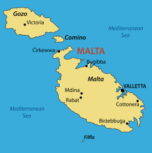 The Maltese archipelago (group of islands) is situated in the Mediterranean Sea, 90km (56 miles) south of the Italian island of Sicily. The three main islands that make up the group are Malta, Gozo and Comino. There are also three small, uninhabited islands. The many rocky coves around its coast form deep, natural harbours, which have featured In Malta’s history since it was first inhabited. Today the island group forms the most densely populated country in Europe.

(I put this picture in especially for fellow blogger Prateek Kohli. He told me he loved learning about Malta at school because the Maltese flag was so easy to draw. You know… I think he’s right!)
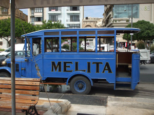
The first people arrived in Malta around 4000 BC – Stone-age farmers from Sicily, who brought their animals, pottery, bags of seed and flint with them. Many hundreds of years later, around 1800 BC, they built wonderful temples on the islands, the remains of which can still be seen today, along with many examples of their sculpture and carved wall decorations:  Soon after this time, new invaders arrived and the temple builders disappeared – either through extermination or slavery. And so Malta’s story continues, with a number of different invasions over the years – through the Bronze and Iron Ages, and the Phoenician (800 BC) and Roman invasions. It was the Romans who named the island we call Malta today, ‘Melita’. The name is remembered on the little blue buses, occasionally seen today. The photo of the one above was taken last year when we were in Sliema. The name ‘Melita’ means ‘honey’, and there has been much discussion as to why this name was given to the island. My first though was that it was because of the wonderful honey-coloured rock which comprises most of Malta.
  Very few buildings are constructed of any other stone, and from the air the island looks decidedly yellow – especially after the dry summers, when vegetation is well parched. Another theory regarding the name is probably more likely. The island was covered in wild thyme – and bees just love thyme. Being the enterprising people they were, the Romans made good use of that fact and kept lots of bees. There is evidence for their hives in various locations, and they probably considered this fertile and beautiful island their little ‘honey-pot’. The Romans built their capital city where the modern Rabat/Mdina are situated. They called that city, Melita, too.
Since Roman times, Malta has seen Byzantine rule, followed by that of the Arabs who invaded in 870. Arab rule continued until the Normans arrived, and in about 1298, the then homeless Knights of St. John (also known as the Knights Hospitallers) made the island their new home – a home that was to last until the 18th century. They made improvements in Malta’s defences, but it was not until the attacks by the Ottoman Turks started in 1547 that defences were strengthened in earnest.
The ‘Great Siege’ of 1565 is so well documented, and I won’t go into it now. But eventually, the Turks were driven back and the Knights of St. John continued to improve the island. It was Grand Master Jean Parisot de Valette who ordered the building of the new capital city of Valletta. (And yes, Valette’s name does only have only one ‘l’ and isn’t another of my typos). Here is a picture of him:
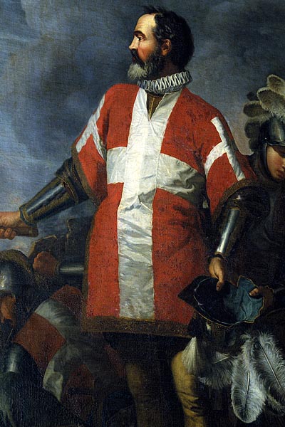
portrait of the Grand Master Jean de la Vallette-Parisot (1557-1568), founder of Valletta
Photo by Giulio Andreini, edited by Clive Gerada. Public Domain
Life was not easy for the people under the Order of St. John; rules were strict and punishments extreme. But by the latter part of the 18th century, the Order started to deteriorate and when Napoleon invaded, the last Grand Master surrendered without resistance. French rule lasted until the British took command in 1814. Complete independence for Malta came in 1964, although self-government had already been granted in 1921.
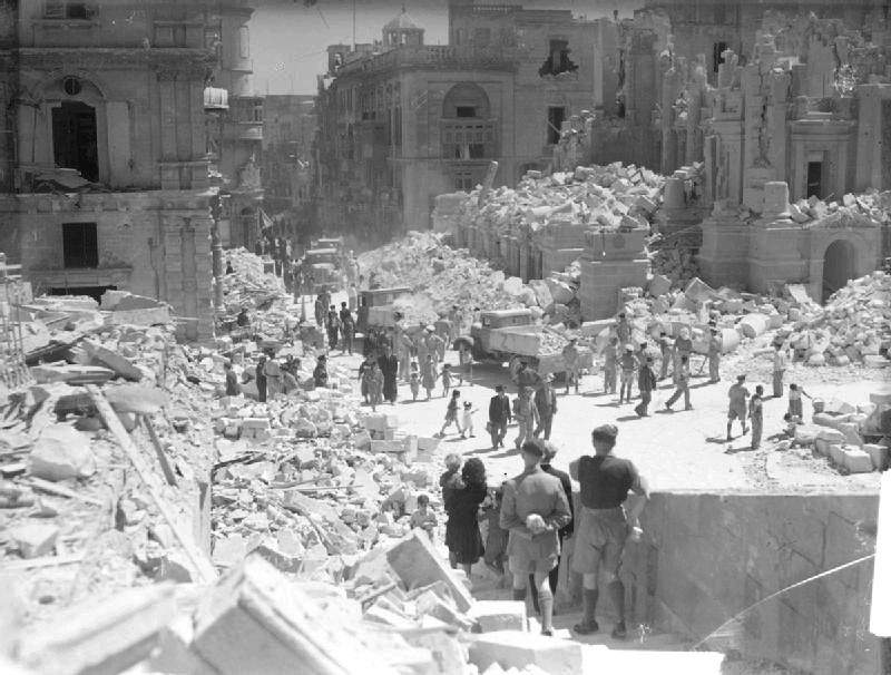
I couldn’t write about Malta’s history without saying a little about the island’s amazing bravery during WW2, for which it was awarded the George Cross, Britain’s highest civilian honour for bravery. As it had done throughout history, Malta’s location again meant it played central stage – and, as such, the Islands ended the war completely devastated. Malta holds the record for the heaviest, sustained bombing attack:154 days and nights and 6,700 tons of bombs. In 1947, the Islands were granted £30 million to help rebuild. But it took many years and further restructuring once the British forces left Malta completely in 1979, to rebuild the economy.
The Maltese islands offer so much to holidaymakers. They have everything from delightful coves and fishing villages to wonderful archaeological sites and bustling cities and towns. There are many museums that focus on the various historical periods, many cafes, restaurants and bars. The beaches are not striking in some areas, being narrow and rocky, but there are sandy beaches to be found – the most notable and largest at Mellieha Bay in the north of Malta. It has been described as one of the best beaches in the Mediterranean.
The Maltese language is fascinating, with words stemming from the many past invaders’ languages. The Arabic sounds are prevalent, with some words being more like Italian. ‘Thank you’ for example is ‘Grazie’. Most people on the islands also speak English, which is taught in all the schools. This is definitely a bonus for us, as neither of us speak Maltese!
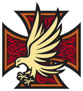
This last image is of the famous Maltese Falcon set against the Maltese Cross: