I intended to show the video (below) on the post I wrote in early October about some of the sites we’d visited during our holiday in Iceland. (A glimpse of Iceland). Well… I can come up with several excuses for not doing so, but the main ones are simply that I hadn’t got around to getting it onto YouTube – and then, when I did, it looked far too jumpy and shaky to use.
The moral of the story is that for good, ‘steady’ videos we need a tripod. It’s impossible not to be jostled around at popular tourist spots and holding a camera perfectly level whilst moving it along to show different aspects of the feature is a big no-no (for me anyway).
Gullfoss (Golden Falls) is the most spectacular and well known of the Icelandic waterfalls, and we visited it as part of the popular Golden Circle Tour. The roaring noise is fascinating! Anyway, here’s the shaky video:
The second half of this video has somehow been lopped off – which is probably just as well, as it was far worse than the first half!
Here’s a little bit of additional information about these falls, mostly from tourist information boards at the site:
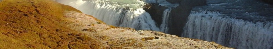
The Gullfoss Falls are on the River Hvitá where it descends from the highlands into the Hvítårgljúfor Canyon. The waterfall cascades in two tiers into the canyon and is about 31m high. The upper waterfall faces south and is 11 m high, the lower one faces west and is 20 m high. The two tiers can be seen in this photo:
For many years attempts were made to buy or rent the waterfall and harness its power, and disputes continued throughout the 20th century. A woman named Sigridur Tómasdóttir (1871-1957), a farmer’s daughter and later owner of the nearby farm, Brattholt, became ‘standard bearer’ in the fight to protect the Gullfoss, and devoted most of her long life to preventing its destruction.
Happily, Gullfoss and its environs were designated a nature reserve in 1979.
There are a couple of theories as to why these falls became known as the ‘Golden Falls’. The first is because of the golden evening hue which often colours its glacial waters. The second is that the name was inspired by the rainbow that often appears when the sunshine hits the water spray. But I prefer this story, which tallies with all the other fanciful tales abounding in Iceland. It was found in the travel journal of Sveinn Pálsson:
A farmer named Gýgur lived at Gýgurjarhóll. He had plenty of gold and could not bear the thought of anyone else having it after he’d died. (What a meanie!) So he placed the gold in a coffer and threw it in the waterfall – which has been called Gullfoss ever since.
Well that’s the last post I’ll be doing on Iceland – for a while, anyway 🙂
Last week we had a short break in Iceland – ‘short’ meaning just five days. In that time we managed to see some of the island as well as the capital city of Reykjavik where our hotel was located. This post is just an introduction to Iceland with a few of the many photos we took over the week. I’ll post about some of the places we visited over the next few weeks. Well, that’s the plan.
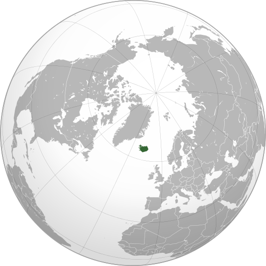
The Republic of Iceland is a sparsely populated Nordic island country located in the North Atlantic Ocean:
Location of Iceland. Author: Ninrouter. Creative Commons
It has a population of 332,529, of which 206,000 – roughly two-thirds – live in Reykjavik, the capital city in the south-west of the island.
A map of Iceland showing the major towns, rivers, lakes and glaciers. Translated from a map on the Greek Wikipedia. Author: Max Naylor, 2007. Public Domain.
Iceland’s location on the Mid-Atlantic Ridge, dividing the Eurasian and American continental plates, results in the island being volcanically and geologically active and is famous for its hot springs, geysers and active volcanoes.
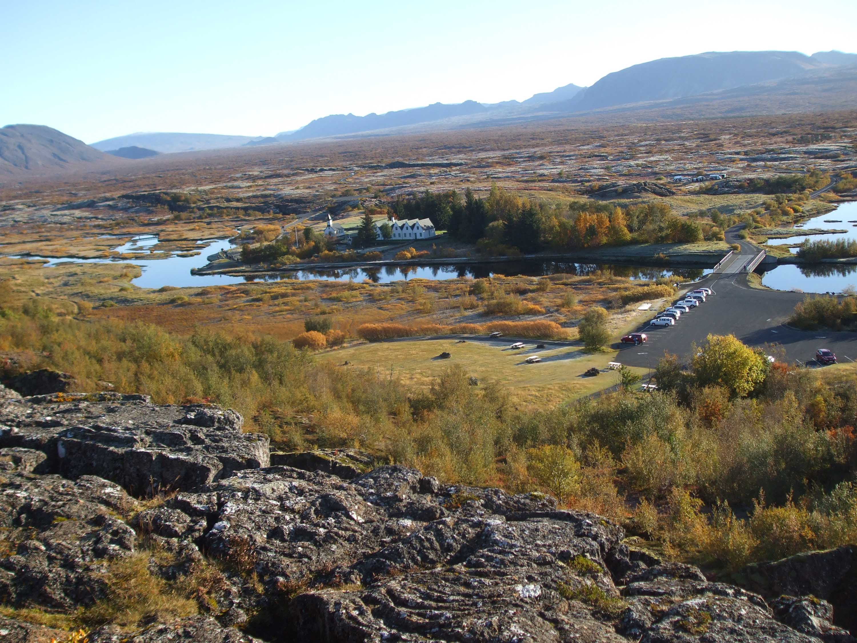
Þingvellir National Park (anglicised Thingvellir) looking from the viewing platform on the North American tectonic plate, across the rift valley to the Eurasian plate. This is the site of the foundation of the Icelandic parliament, which I’ll write about in another post, and is now one of the most popular tourist destinations on the island.
There are 130 active and dormant volcanoes in Iceland, eighteen of which have erupted since the first settlers arrived around AD 900. Perhaps the best known ones are Hekla (once believed to be the entrance to hell) Katia and Krafla. And, of course, most people know of the volcanic island of Surtsey – which made its appearance in 1963. Lava fields cover 11% of the land and waterfalls and glaciers can be seen in the highlands.
Gullfoss is one of the most spectacular of the many waterfalls in Iceland.
Lava fields cover much of Iceland.
Short trees are now growing where the soil is suitable.
Churches are very varied in Iceland. We were told that in the countryside, some are on wheels so they can be transported to wherever the couple wants the wedding to take place.
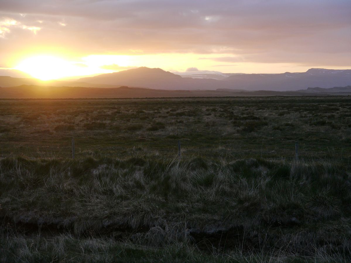
Isolated farms and houses are a feature across the open land. Left to roam free, the sheep feed on the grasses and herbs, which give Icelandic lamb its ditsinctive flavour.
Hot water is pumped from underground to supply much of the country’s heating. Geothermal energy provides roughly 25% of Iceland’s electricity, the rest being mainly from HEP and only 0.1% from fossil fuels. Geothermal energy in Iceland has been used for many years for bathing and washing, as well as for central heating systems in buildings. Pipes also run beneath the pavements in cities like Reykjavik and Akureyri to keep them ice free in winter.
Strokkur geyser at Geysir. Strokkur is a very determined geyser and erupts every 5-10 minutes!
Geothermal hot water distribution in Reykjavik.
Litli Geyser at Geysir geothermal field.
Despite Iceland’s latitude close to the Arctic Circle, the general climate of southern, coastal areas is described as temperate, although the high latitude and the influence of the sea keep summers chilly. Inland in the highlands, where the climate is tundra, glacial rivers make their way down to the sea. In winter, nights are extremely long and dark, the only daylight being between 11 am and 4 pm, whereas in summer the nights are bright all over the island. In June the sun never fully sets in the north of Iceland.
Landscape at Akranes in Western Iceland at 11pm on June 9th 2016. Author: Zairon. Creative Commons
It’s often been thought that the absence of forests in Iceland is because of its latitude and thin volcanic soils. That is not the case. The island was once naturally forested, but settlement since 900 and the resultant burning of scrubland for the grazing of livestock and forest clearance for buildings, fuel and so on are the main cause. Over the last hundred years, several reforestation schemes have been started, with varying degrees of success with different tree species. But in recent years increased afforestation is noticeable across areas of open countryside, although many of these young trees are naturally still very short and stubby. Around Reykjavik, however, many homes and public buildings have trees around them, mostly silver birch, rowan or various species of conifer:
Unlike the rest of Europe, Iceland remained uninhabited until the 8th century. Irish monks came to the islands and, although they left no physical trace, crosses have been found carved into a cave wall. Within a hundred years, Norwegian settlers arrived. These people were thought to be escaping from persecution and economic hardship at home. The official ‘first settler’ was Ingólfur Arnarson in 874.
Ingolf Arnarson, the first permanent settler in Iceland. Author: Johan Peter Raadsig (1806-1880). Uploaded by User:Haaukurth. Public Domain.
Ingolf Arnarson and his wife Hallveig arriving in Iceland. Photo taken in the Saga Museum in Reykjavig.
During the following centuries many Norwegians and a few other Scandinavians settled in Iceland, bringing with them Gaelic thralls (slaves). Icelandic culture is founded on this Scandinavian heritage. The language is descended from Old Norse and is closely related to the Faroese and West Norwegian dialects.
Between 1262 and 1814, Iceland was ruled first by Norway and then Denmark. It became independent in 1918 and a republic in 1944. The monetary unit is the Icelandic króna and if you decide to visit this intriguing country, be prepared to splash out! Iceland is a very expensive place – food/eating out, all alcohol, clothing and other souvenir items are far from cheap. But the island is a fabulous place for anyone interested in geology, the natural world, or history – or a combination of all of these. Whale watching trips are popular, as are boat trips out to see the puffins.
Iceland is fast becoming one of the most popular tourist destinations in the world, last year seeing a record breaking number of visitors. This isn’t really surprising as the island has so much to offer in whichever season tourists decide to visit.In the coldest months, winter sports and activities are on offer. We picked September this time simply because of the high chance of seeing the Northern Lights/Aurora Borealis at that time. We weren’t disappointed – except for the fact that we really need better cameras to do justice to the event! Needless to say, our photos of the Lights aren’t very clear – but at least we can say we’ve seen them. This photo was taken over Reykjavik harbour.
To finish with, here are a few photos of Iceland, all but the Icelandic horses taken in Reykjavik.
The Hallgrimskirkja. This church dominates the skyline in Reykjavik.
Along the waterfront (harbour).
A couple of friendly trolls in Reykjavik.
Woollen goods are on sale in many places in Iceland. Their designs are quite distinctive.
A Viking!
Viking and polar bear in Saga Museum. Polar bears visit Iceland occasionally – generally along the north coast.
Main street of Reykjavik at night.
Icelandic horses are strong, sturdy but short, but are not referred to as ponies. They were bred on Iceland from breeds fetched over with the original Norwegian settlers.


.svg)